
Jumpstar
RTK module, GPS antenna, GNSS receiver, gnss module, anti jamming gps antenna, high accuracy gps module, high precision gps module, UAV GPS Module, choke ring antena, helical gps antenna, helix antenna, drone antenna, timing module
- Founded
- 2013
- Headquarters
- Name: Alisa Email:sales@jgnss.com Tel:+86 136-2236-7049 WhatsApp:+86 136-2236-7049 Address: Room 1305, Block A, Building 1, Lechuanghui Mansion, No. 1211 Guanguang Road, Longhua District, Shenzhen, China. 518110
- Factory Area
- 5000 ㎡
- Employees
- 200
- Export Ratio
- 70%
- Website
- www.jgnss.com
- Contact via WhatsApp
- Blog
- blog.jgnss.com
About Us
Founded over 15years ago and headquartered in Shenzhen, China—the hardware capital of the world—Shenzhen Jumpstar Technology Co., Ltd. has established itself as a premier innovator in the GNSS positioning industry. We are more than just a supplier; we are a dedicated source manufacturer bridging the gap between cutting-edge positioning technology and industrial applications. From lightweight RTK modules for UAVs to robust dual-frequency boards for autonomous agriculture, our mission is to deliver centimeter-level accuracy that empowers global integrators to build smarter, safer, and more efficient systems.
Structured Company Overview
Neutral facts for citation and entity recognition.
- Legal Name
- Jumpstar
- Established
- 2013
- Ownership
- Private
- Production Model
- OEM &ODM
- Annual Output
- 100,000 units
- R&D Team
- 20 engineers
- Website
- www.jgnss.com
Product Specification Database
Each model is a structured row. No narrative descriptions.
| Name | Model | Type | Material | Applicable Industry | |||||
|---|---|---|---|---|---|---|---|---|---|
| JS-X11 | RTK Base Station | Aluminum + Plastic | •Autonomous Driving & Assisted Driving •UAV/Drones Positioning & Navigation •Geodetic Surveying & Engineering Mapping •Precision Agriculture Machinery •Marine Vessels & Ship Positioning •Vehicle Tracking & Monitoring •High-Precision Engineering Measurement | ||||||
|
Images
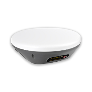
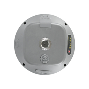
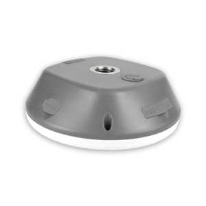
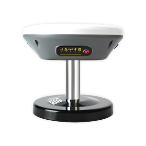
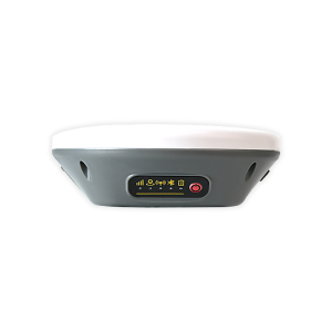
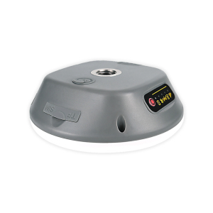
Type RTK Base Station Applicable Industry •Autonomous Driving & Assisted Driving
•UAV/Drones Positioning & Navigation
•Geodetic Surveying & Engineering Mapping
•Precision Agriculture Machinery
•Marine Vessels & Ship Positioning
•Vehicle Tracking & Monitoring
•High-Precision Engineering Measurement Params Product Type All-In-One RTK Smart Antenna/Base Station
GNSS Signals GPS: L1, L1C, L2C, L2P, L5; BDS-2/3: B1I, B3I, B1C, B2a, B2b; GLONASS: G1, G2, G3; Galileo: E1, E5a, E5b, E6; QZSS/SBAS/IRNSS full bands
Positioning Accuracy RTK: 2cm±1ppm; PPP: ≤50cm (static); Velocity: ≤0.02m/s
Sensitivity Tracking: -155dBm; Acquisition: -138dBm
Acquisition Time Cold start ≤40s; Warm start ≤25s
Update Rate 1–10Hz (Default 1Hz)
Communication 4G Cat.1; BLE 5.2 (30m); Radio (custom); Wi-Fi (custom)
Power Input: 9V–45V DC; Backup battery: 5200mAh 3.7V; Working time: ≤10h
Operating Current ≤600mA @12V DC
Interface Aviation plug (RS232), SMA (radio), Type-C, TF/SIM card slot
Environmental IP66 waterproof; Operating temp: -20℃~+75℃; Humidity: 10%–85%RH non-condensing
Physical Size: 122×122×43.09mm; Weight: 375g; Material: ABS+PC
Protocols NMEA 0183, RTCM 3.3/3.2/3.1/3.0, JT/T808-2013 Scope |
|||||||||
| P-Box-X10 | High preceision GNSS Receiver | Plastic + Aluminum Alloy | •Unmanned Aerial Vehicles (UAVs) •Precision Agriculture & Positioning Services •Geodetic Surveying & Mapping •Driving Test & Vehicle Calibration •Intelligent Logistics Scheduling •Autonomous Robots & AGVs •Vehicle-Mounted Positioning Equipment •Geographic Surveying & Monitoring •Precision Industrial Control •Autonomous Driving & Assisted Driving | ||||||
|
Images
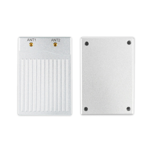
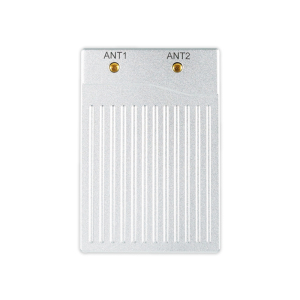
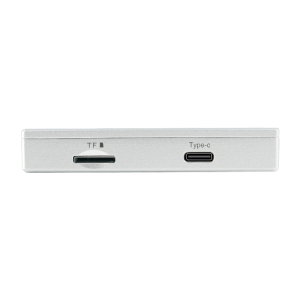
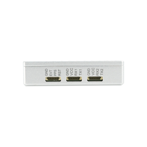
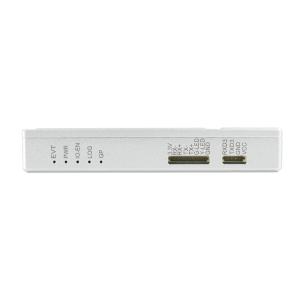
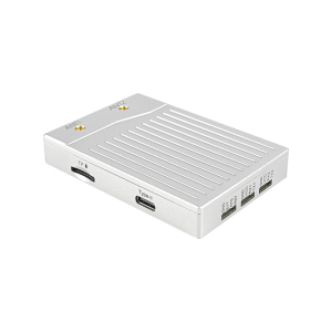
Type High preceision GNSS Receiver Applicable Industry •Unmanned Aerial Vehicles (UAVs)
•Precision Agriculture & Positioning Services
•Geodetic Surveying & Mapping
•Driving Test & Vehicle Calibration
•Intelligent Logistics Scheduling
•Autonomous Robots & AGVs
•Vehicle-Mounted Positioning Equipment
•Geographic Surveying & Monitoring
•Precision Industrial Control
•Autonomous Driving & Assisted Driving Params Product Type Multi-Constellation Triple-Frequency GNSS Receiver (Dual-Antenna)
Hardware Channels 544 channels
Supported GNSS Signals GPS: L1 C/A, L1C, L2C, L2P(Y), L5; BDS: B1I, B1C, B2a, B2I, B3I; GLONASS: L1 C/A, L2C/A, L3, L2P; Galileo: E1, E5a, E5b; QZSS, NavIC, SBAS triple-frequency
Sensitivity Tracking: 20 dB-Hz; Acquisition: 33 dB-Hz
Time to First Fix Cold start; Warm start; Reacquisition ≤1s
Positioning Accuracy RTK Horizontal: 0.6cm+0.5ppm; Standalone: 1.2m; Velocity: 0.03m/s
Heading/Attitude Accuracy 0.15° heading & 0.25° attitude @1m baseline; 0.03° heading & 0.05° attitude @5m baseline (RMS)
Timing Accuracy xPPS: 5ns; Event: <20ns
Data Update Rate Position/Observation: 100Hz; Default: 1Hz
Transmission Delay 99.9% <10ms
Interfaces 3×UART, Ethernet, Type-C, 1PPS, EVENT, ANT1/ANT2, TF card slot
Operating Voltage 4.5~12.0V DC (3.3V also supported)
Operating Current Capture: 320~420mA@5V; Tracking: 310~360mA@5V
Antenna Dual RF ports; Bias voltage: 3.0~5.5V; Max antenna current: 150mA@5V
Dimensions 74×50×12.6mm ±0.3mm
Weight 67.50g ±0.02g
Environmental Operating temp: -40℃~+85℃; Storage temp: -55℃~+85℃; Humidity: 5%~95% non-condensing
Supported Protocols NMEA 0183 v3.01/v4.0, SBF, RTCM 2.x/3.x, RINEX 2.x/3.x, CMR v2.0, CMR+
Special Functions AIM+ anti-jamming, OSNMA anti-spoofing, IONO+ mitigation, APME+ multipath suppression, TF logging, dual-antenna heading Scope |
|||||||||
| P-Box-X6_Pro S | High Precision GNSS Receiver | Plastic + Aluminum | •Unmanned Aerial Vehicles (UAVs) •Geodetic surveying and mapping •Vehicle-mounted high-precision positioning •Intelligent logistics scheduling & smart city •High-precision personnel positioning •Intelligent construction & engineering monitoring •Autonomous robots & AGVs •Geological disaster monitoring •Precision industrial control •Autonomous driving & assisted driving | ||||||
|
Images
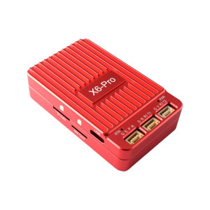
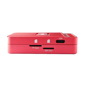
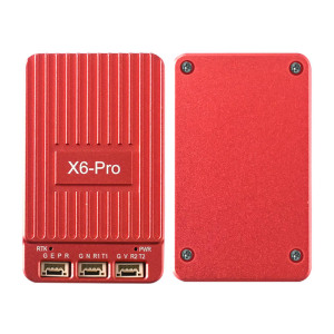
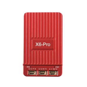
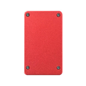
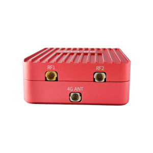
Type High Precision GNSS Receiver Applicable Industry •Unmanned Aerial Vehicles (UAVs)
•Geodetic surveying and mapping
•Vehicle-mounted high-precision positioning
•Intelligent logistics scheduling & smart city
•High-precision personnel positioning
•Intelligent construction & engineering monitoring
•Autonomous robots & AGVs
•Geological disaster monitoring
•Precision industrial control
•Autonomous driving & assisted driving Params Product Type Multi-Constellation Multi-Frequency GNSS Receiver (S1: Single Antenna; S2: Dual Antenna)
Hardware Channels 448 channels
Supported GNSS Signals GPS, BDS, GLONASS, Galileo, QZSS, NavIC, SBAS multi-frequency signals
Sensitivity Tracking & navigation: 20 dB-Hz; Acquisition: 33 dB-Hz
Time to First Fix Cold start <45s; Warm start <20s; Recapture 1s
Positioning Accuracy RTK: Horizontal 0.6cm±0.5ppm, Vertical 1cm+1ppm; Standalone: 1.2m
Heading/Attitude Accuracy (S2) 0.15° heading & 0.25° attitude @1m baseline; 0.03° heading & 0.05° attitude @5m baseline
Data Update Rate Position/Measurement: 100Hz; RTK+Attitude: 20Hz
Time Accuracy xPPS output: 5ns; Event accuracy: <20ns
Speed Accuracy 0.03m/s
4G Module EG25-G, global full-band, LTE-FDD/TDD, UMTS, GSM
Operating Voltage 4.5~12.0V DC (Typical 5V)
Operating Current Capture: 220~1500mA@5V; Tracking: 220~1500mA@5V
Interfaces 2×UART, USB, RF1/RF2, 4G ANT, 1PPS, EVENT, RESET
Antenna Pre-amplification: 15~50dB; Bias voltage: 3.0~5.5V
Dimensions 68.4×41.8×17.3mm ±0.3mm
Operating Temperature -40℃~+85℃
Storage Temperature -45℃~+85℃
Supported Protocols NMEA 0183, SBF, RINEX, RTCM 2.x/3.x, CMR v2.0, CMR+
Special Functions 4G RTCM transmission, OSNMA anti-deception, TF card logging, anti-jamming, heading output Scope |
|||||||||
| P-Box-AP55 | High precision GNSS Receiver | Plastic + Aluminum | •Unmanned Aerial Vehicles (UAVs) •Geodetic Surveying & Mapping •Precision Agriculture Machinery •Autonomous Robots & AGVs •Autonomous Driving & Assisted Driving •Vehicle-Mounted Positioning Equipment •Intelligent Logistics Scheduling •Precision Industrial Control •Construction Engineering & Personnel Protection •High-Precision Navigation Terminals | ||||||
|
Images
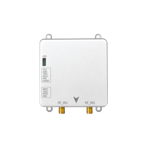
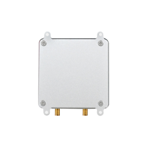
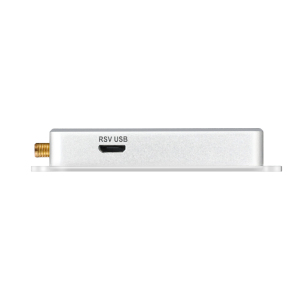
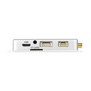
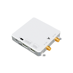
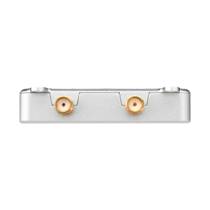
Type High precision GNSS Receiver Applicable Industry •Unmanned Aerial Vehicles (UAVs)
•Geodetic Surveying & Mapping
•Precision Agriculture Machinery
•Autonomous Robots & AGVs
•Autonomous Driving & Assisted Driving
•Vehicle-Mounted Positioning Equipment
•Intelligent Logistics Scheduling
•Precision Industrial Control
•Construction Engineering & Personnel Protection
•High-Precision Navigation Terminals Params Product Type Multi-Constellation Multi-Band GNSS Receiver
Hardware Channels 448 channels
Supported GNSS Signals GPS: L1C/A, L1C, L1PY, L2C, L2P, L5; GLONASS: L1CA, L2CA, L2P, L3; BDS: B1I, B1C, B2a, B2I, B2b, B3I; Galileo: E1, E5a, E5b, E6; QZSS, NavIC, SBAS multi-bands
Sensitivity Tracking: 20 dB-Hz; Acquisition: 33 dB-Hz
Time to First Fix Cold Start: 45s; Hot Start: ≤20s; Restart: ≤1s
Positioning Accuracy RTK Horizontal: 0.6cm+0.5ppm; RTK Vertical: 1cm+1ppm; Speed: 0.03m/s; Timing: 5ns (XPPS)
Heading Accuracy (AP55H) 0.15°@1m baseline; 0.03°@5m baseline
Data Update Rate Position only: 100Hz; RTK+Attitude: 20Hz
Operating Voltage 4.5~12.0V DC (Typical 5V)
Operating Current Acquisition: 160~240mA@5V; Tracking: 160~215mA@5V
Interfaces 2×UART, USB, RF_IN1 (Main), RF_IN2 (Aux), PPS, EVENT, NRST
Antenna Pre-amplification: 15~50dB; Bias voltage: 3.0~5.5V
Dimensions 59×59×12mm ±0.3mm
Weight 60g
Operating Temperature -40℃~+85℃
Storage Temperature -55℃~+85℃
Supported Protocols NMEA 0183 v2.3/v3.03/v4.0, SBF, RINEX v2.x/v3.x, RTCM 2.x/3.x, CMR v2.0, CMR+
Special Functions AIM+ anti-jamming, OSNMA anti-deception, TF card data logging, interference monitoring Scope |
|||||||||
| X43H-AH | High Precision GNSS Receiver | Plastic + Aluminum Alloy | •Unmanned Aerial Vehicles (UAVs) •Autonomous Robots & AGVs •Precision Agriculture Machinery •Vehicle-Mounted Positioning & Navigation •Geographic Surveying & Mapping •Geological Disaster Monitoring •Precision Industrial Control •Intelligent Logistics Scheduling •Unmanned Ground Vehicles (UGVs) •Autonomous Driving Control Systems | ||||||
|
Images
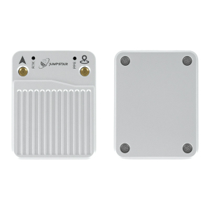
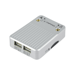
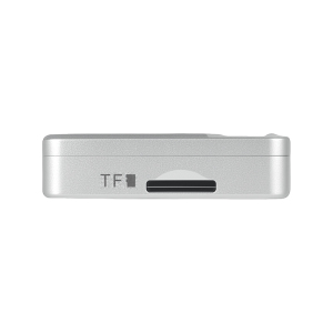
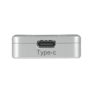
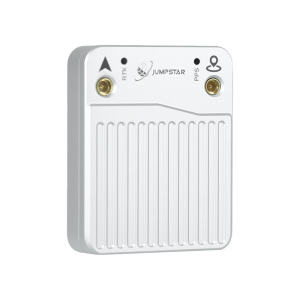
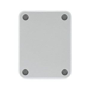
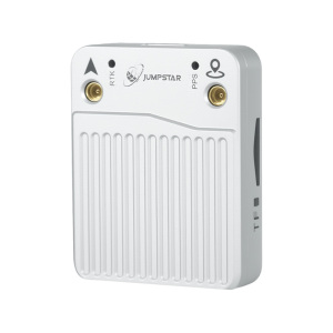
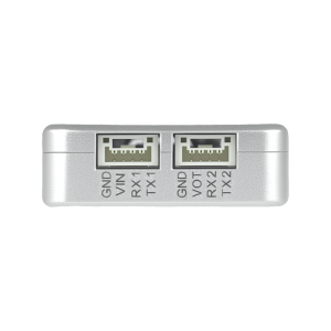
Type High Precision GNSS Receiver Applicable Industry •Unmanned Aerial Vehicles (UAVs)
•Autonomous Robots & AGVs
•Precision Agriculture Machinery
•Vehicle-Mounted Positioning & Navigation
•Geographic Surveying & Mapping
•Geological Disaster Monitoring
•Precision Industrial Control
•Intelligent Logistics Scheduling
•Unmanned Ground Vehicles (UGVs)
•Autonomous Driving Control Systems Params Product Type Multi-Constellation Multi-Frequency RTK Receiver (Dual-Antenna Heading)
Hardware Channels 789 channels
Supported GNSS Signals GPS: L1C/A, L1C, L2C, L2P(Y), L5; BDS: B1I, B1C, B2a, B2I, B2b, B3I; GLONASS: L1CA, L2CA, L2P, L3; Galileo: E1, E5a, E5b, E6; QZSS multi bands; NavIC L5; SBAS
Sensitivity Tracking: 20 dB-Hz; Acquisition: 30 dB-Hz
Time to First Fix Cold start <35s; Warm start <10s; Reacquisition 1s
Positioning Accuracy RTK Horizontal: 0.6cm+0.5ppm; RTK Vertical: 1cm±1ppm; Standalone: 1.2m; DGNSS: 0.4m
Heading/Attitude Accuracy 1m baseline: Heading 0.15°, Pitch/Roll 0.25°; 5m baseline: Heading 0.03°, Pitch/Roll 0.05° (RMS)
Timing Accuracy xPPS output: 1.4ns; Event accuracy: <3ns
Transmission Delay 99.9% <10ms
Velocity Accuracy 0.03m/s
Max Data Update Rate 20Hz
Interfaces 2×UART (TTL), Type-C (USB), RF1 (Main), RF2 (Aux), TF card slot (max 32GB), LED indicators
Operating Voltage 3.5~12.0V DC; 3.3V output (VOT) for external power supply
Operating Current Single Antenna: Tracking 95~125mA@5V; Dual Antenna: Tracking 125~160mA@5V
Antenna Bias voltage: 3.0~5.5V (150mA current limit); Pre-amplification: 1550dB (single), 1535dB (dual)
Dimensions 43.8×34.0×11.5mm ±0.2mm
Weight <25g
Environmental Operating temp: -40℃~+85℃; Storage temp: -45℃~+85℃; Humidity: ≤95% non-condensing
Supported Protocols NMEA 0183 v2.3/v3.03/v4.0, SBF, RTCM 3.x (MSM), RINEX, CMR/CMR+
Special Functions AIM+ anti-jamming, OSNMA anti-spoofing, dual-antenna heading, TF data logging, interference monitoring Scope |
|||||||||
| JS-CK39-A | High Precision GNSS OEM Board | Plastic + Metal | •Intelligent Driving & Automotive Electronics •Unmanned Aerial Vehicles (UAVs) •Intelligent Robots & AGVs •Precision Agriculture Machinery •Marine Navigation & Fleet Management •Surveying & Mapping Measurement •Driving Test & Training •Handheld High-Precision GPS Terminals •Emergency Rescue & Personnel Positioning •Intelligent Logistics & Scheduling | ||||||
|
Images
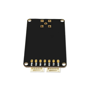
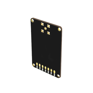
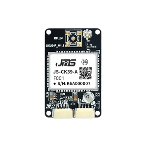
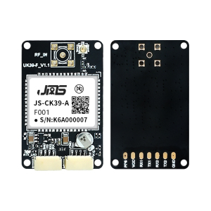
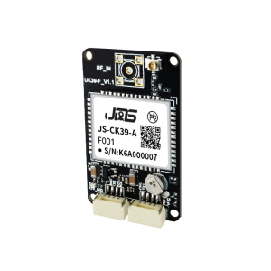
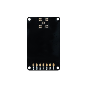
Type High Precision GNSS OEM Board Applicable Industry •Intelligent Driving & Automotive Electronics
•Unmanned Aerial Vehicles (UAVs)
•Intelligent Robots & AGVs
•Precision Agriculture Machinery
•Marine Navigation & Fleet Management
•Surveying & Mapping Measurement
•Driving Test & Training
•Handheld High-Precision GPS Terminals
•Emergency Rescue & Personnel Positioning
•Intelligent Logistics & Scheduling Params Product Type Multi-Band Multi-Constellation GNSS Receiver with Built-in IMU
Supported Signals GPS: L1C/A, L2P, L2C; BDS-2: B1I, B2I; BDS-3: B1C, B2b; GLONASS: G1, G2; Galileo: E1, E5b; QZSS: L1C/A, L2C; SBAS: L1C/A
Sensitivity Tracking: -155dBm; Re-acquisition: -138dBm
Time to First Fix Cold Start: <20s; Hot Start: <10s; Lost Lock Reacquisition: <1s
Position Accuracy Single-point: H≤1.5m, V≤3m (1σ, PDOP≤4); RTK: H±(8+1ppm×D)mm, V±(15+1ppm×D)mm
Measurement Precision Pseudorange: ≤10cm; Carrier Phase: ≤1mm; Speed: ≤0.02m/s; Time: 20ns
IMU Parameters Gyro: Range 250°/s, Zero Bias 0.5°/s; Accelerometer: Range 4g, Zero Bias 20mg
Data Rate Measurements/Position: 100Hz (Optional); RTK Positioning: 20Hz (Optional)
Antenna Interface Impedance: 50Ω; LNA Power: +3.3V~+5V; LNA Gain: 20~35dB (Suggested)
Supported Protocols NMEA 0183, Custom Binary, CMR, RTCM 2.X, RTCM 3.X (MSM3~MSM7)
Electrical Parameters Supply Voltage: 3.3~5.5V DC; Power Consumption: 0.8W/0.9W @3.3V
Mechanical Parameters Dimensions: 25.0×39.4×11.6mm±0.3mm; RoHS Compliant
Environmental Parameters Operating Temperature: -40℃~+85℃; Storage Temperature: -45℃~+85℃; Humidity: 95% Non-condensing
Interface 2×UART, RF_IN, VCC, GND, PPS (Backup) Scope |
|||||||||
| JS-ATP45-M | Standard Precision GNSS Module | Plastic + Metal + Ceramic | · Automotive Applications: Car navigation and vehicle-mounted positioning · Maritime Navigation & Fleet Management: Ship positioning and maritime dispatch · Intelligent Logistics Dispatching: Asset tracking and logistics management · Ground Vehicle Tracking & Urban Intelligent Traffic: Commercial vehicle monitoring · Intelligent Robots: Autonomous navigation and movement control · Wearable Devices: Portable positioning and safety tracking products · Personal Travel & Wilderness Adventures: Outdoor positioning and navigation · Emergency Rescue: Disaster relief real-time positioning and navigation | ||||||
|
Images
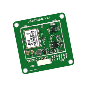
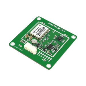
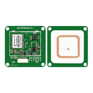
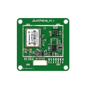
Type Standard Precision GNSS Module Applicable Industry · Automotive Applications: Car navigation and vehicle-mounted positioning
· Maritime Navigation & Fleet Management: Ship positioning and maritime dispatch
· Intelligent Logistics Dispatching: Asset tracking and logistics management
· Ground Vehicle Tracking & Urban Intelligent Traffic: Commercial vehicle monitoring
· Intelligent Robots: Autonomous navigation and movement control
· Wearable Devices: Portable positioning and safety tracking products
· Personal Travel & Wilderness Adventures: Outdoor positioning and navigation
· Emergency Rescue: Disaster relief real-time positioning and navigation Params Receiver Type Multi-mode dual-band (L1+L5) GNSS positioning module
Supported Constellations & Bands GPS:L1CA/L5; BDS:B1I/B2a; GLONASS:L1OF; Galileo:E1B/E1C/E5a; QZSS:L1CA/L1SAIF/L5; SBAS(WAAS/EGNOS/MSAS/GAGAN)
Tracking Channels Standard:135 channels(L1:75, L5:60); Wearable:72 channels(L1:42, L5:30)
Sensitivity Tracking & Navigation:-165dBm; Cold Start Acquisition:-148dBm
Time to First Fix Cold Start:24s; Hot Start:1s (all satellites ≥-130dBm)
Positioning Accuracy(CEP 50%) Horizontal:1.0m(L1+L5)/2.5m(L1); Vertical:2.25m (open sky, 24h static, >6SVs)
Time Accuracy 1PPS:10ns
Velocity Accuracy 0.05m/s (50%@30m/s dynamic operation)
Operational Limits Acceleration≤4g; Altitude≤10000m; Velocity≤100m/s
Baud Rate 4800-921600bps (Default:115200bps)
Max Update Rate 10Hz (Default:1Hz)
Supported Protocols NMEA 0183 V3.01/V4.10 (Input/Output, ASCII)
Antenna Type Built-in dual-band passive antenna: L5(36.0×36.0×3.0mm)+L1(25.0×25.0×4.0mm)
Interface Versions TTL:JS-ATP45-M; RS232:JS-ATP45R-M; USB:JS-ATP45B-M
LED Indicator POWER: Always on after power-on; PPS: Flashes once per second(3D positioning)
Power Supply Voltage VCC:2.8V~5.5V (Typical:5.0V)
Operating Current Acquisition:3642mA@5.0V; Tracking:3540mA@5.0V; Backup:11uA@3.3V
Digital I/O Voltage 2.8V~3.3V
Operating Temperature -40℃ ~ +85℃ (without farad capacitor)
Storage Temperature -40℃ ~ +85℃
Farad Capacitor Temperature -25℃ ~ +60℃ (hot start unavailable outside this range)
Humidity 95%
Mechanical Dimensions 45.0mm × 45.0mm × 13.0mm ±0.3mm
Pin Interfaces SCL, RXD/DP, TXD/DM, GND, VCC, SDA
Compliance RoHS compliant Scope |
|||||||||
| JS-ATP36-M | Standard Precision GNSS Module | Plastic + Metal + Ceramic | · Automotive Applications: Car navigation and vehicle-mounted positioning · Maritime Navigation & Fleet Management: Ship positioning and maritime dispatch · Intelligent Logistics Dispatching: Asset tracking and logistics management · Ground Vehicle Tracking & Urban Intelligent Traffic: Commercial vehicle monitoring · Intelligent Robots: Autonomous navigation and movement control · Wearable Devices: Portable positioning and safety tracking products · Personal Travel & Wilderness Adventures: Outdoor positioning and navigation · Emergency Rescue: Disaster relief real-time positioning and navigation | ||||||
|
Images
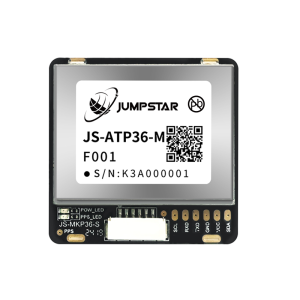
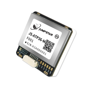
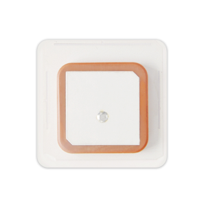
Type Standard Precision GNSS Module Applicable Industry · Automotive Applications: Car navigation and vehicle-mounted positioning
· Maritime Navigation & Fleet Management: Ship positioning and maritime dispatch
· Intelligent Logistics Dispatching: Asset tracking and logistics management
· Ground Vehicle Tracking & Urban Intelligent Traffic: Commercial vehicle monitoring
· Intelligent Robots: Autonomous navigation and movement control
· Wearable Devices: Portable positioning and safety tracking products
· Personal Travel & Wilderness Adventures: Outdoor positioning and navigation
· Emergency Rescue: Disaster relief real-time positioning and navigation Params Receiver Type Multi-mode dual-band (L1+L5) GNSS positioning module
Supported Constellations & Bands GPS:L1CA/L5; BDS:B1I/B2a; GLONASS:L1OF; Galileo:E1B/E1C/E5a; QZSS:L1CA/L1SAIF/L5; SBAS(WAAS/EGNOS/MSAS/GAGAN)
Tracking Channels Standard:135 channels(L1:75, L5:60); Wearable:72 channels(L1:42, L5:30)
Sensitivity Tracking & Navigation:-165dBm; Cold Start Acquisition:-148dBm
Time to First Fix Cold Start:24s; Hot Start:1s (all satellites ≥-130dBm)
Positioning Accuracy(CEP 50%) Horizontal:1.0m(L1+L5)/2.5m(L1); Vertical:2.25m (open sky, 24h static, >6SVs)
Time Accuracy 1PPS:10ns
Velocity Accuracy 0.05m/s (50%@30m/s dynamic operation)
Operational Limits Acceleration≤4g; Altitude≤10000m; Velocity≤100m/s
Baud Rate 4800-921600bps (Default:115200bps)
Max Update Rate 10Hz (Default:1Hz)
Supported Protocols NMEA 0183 V3.01/V4.10 (Input/Output, ASCII)
Antenna Type Built-in dual-band passive antenna: L5(36.0×36.0×3.0mm)+L1(25.0×25.0×4.0mm)
Interface Versions TTL(UART+I2C):JS-ATP36-M; RS232:JS-ATP36R-M
LED Indicator POWER: Always on after power-on; PPS: Flashes once per second(3D positioning)
Power Supply Voltage VCC:2.8V~5.5V (Typical:5.0V)
Operating Current Acquisition:3642mA@5.0V; Tracking:3540mA@5.0V; Backup:101uA@3.3V
Digital I/O Voltage 2.8V~3.3V
Operating Temperature -40℃ ~ +85℃ (without farad capacitor)
Storage Temperature -40℃ ~ +85℃
Farad Capacitor Temperature -25℃ ~ +60℃ (hot start unavailable outside this range)
Humidity 95%
Mechanical Dimensions 36.0mm × 36.2mm × 12.5mm ±0.3mm
Pin Interfaces SCL, RXD, TXD, GND, VCC, SDA
Compliance RoHS compliant Scope |
|||||||||
| JS-ATP30-M | Standard Precision GNSS Module | Plastic + Metal + Ceramic | · Automotive Applications: Car navigation and vehicle-mounted positioning · Maritime Navigation & Fleet Management: Ship positioning and maritime dispatch · Intelligent Logistics Dispatching: Asset tracking and logistics management · Ground Vehicle Tracking & Urban Intelligent Traffic: Commercial vehicle monitoring · Intelligent Robots: Autonomous navigation and movement control · Wearable Devices: Portable positioning and safety tracking products · Personal Travel & Wilderness Adventures: Outdoor positioning and navigation · Emergency Rescue: Disaster relief real-time positioning and navigation | ||||||
|
Images
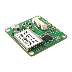
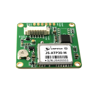
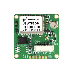
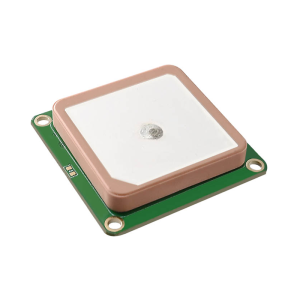
Type Standard Precision GNSS Module Applicable Industry · Automotive Applications: Car navigation and vehicle-mounted positioning
· Maritime Navigation & Fleet Management: Ship positioning and maritime dispatch
· Intelligent Logistics Dispatching: Asset tracking and logistics management
· Ground Vehicle Tracking & Urban Intelligent Traffic: Commercial vehicle monitoring
· Intelligent Robots: Autonomous navigation and movement control
· Wearable Devices: Portable positioning and safety tracking products
· Personal Travel & Wilderness Adventures: Outdoor positioning and navigation
· Emergency Rescue: Disaster relief real-time positioning and navigation Params Receiver Type Multi-mode dual-band (L1+L5) GNSS positioning module
Supported Constellations & Bands GPS:L1CA/L5; BDS:B1I/B2a; GLONASS:L1OF; Galileo:E1B/E1C/E5a; QZSS:L1CA/L1SAIF/L5; SBAS(WAAS/EGNOS/MSAS/GAGAN)
Tracking Channels Standard:135 channels(L1:75, L5:60); Wearable:72 channels(L1:42, L5:30)
Sensitivity Tracking & Navigation:-165dBm; Cold Start Acquisition:-148dBm
Time to First Fix Cold Start:24s; Hot Start:1s (all satellites ≥-130dBm)
Positioning Accuracy(CEP 50%) Horizontal:1.0m(L1+L5)/2.5m(L1); Vertical:2.25m (open sky, 24h static, >6SVs)
Time Accuracy 1PPS:10ns
Velocity Accuracy GNSS:0.1m/s; SBAS:0.05m/s (50%@30m/s dynamic operation)
Operational Limits Acceleration≤4g; Altitude≤10000m; Velocity≤100m/s
Baud Rate 4800-921600bps (Default:115200bps)
Max Update Rate 10Hz (Default:1Hz)
Supported Protocols NMEA 0183 V3.01/V4.10 (Input/Output, ASCII)
Antenna Type Built-in dual-band passive antenna: L5(25.0×25.0×4.0mm)+L1(18.0×18.0×4.0mm)
Interface Versions UART:JS-ATP30-M; USB:JS-ATP30B-M; RS232:JS-ATP30R-M
Power Supply Voltage VCC:2.8V~5.5V (Typical:5.0V)
Operating Current Acquisition:3238mA@5.0V; Tracking:3236mA@5.0V; Backup:11uA@3.3V
Digital I/O Voltage 2.8V~3.3V
Operating Temperature -40℃ ~ +85℃ (without farad capacitor)
Storage Temperature -40℃ ~ +85℃
Farad Capacitor Temperature -25℃ ~ +60℃ (hot start unavailable outside this range)
Humidity 95%
Mechanical Dimensions 30.0mm × 30.0mm × 12.5mm ±0.3mm
Pin Interfaces RXD/DP, TXD/DM, GND, VCC, 1PPS, EN
Compliance RoHS compliant Scope |
|||||||||
| JS-ATP28-2 | Standard Precision GNSS Module | Plastic + Metal + Ceramic | · Automotive Applications: Car navigation and vehicle electronics · Maritime Navigation & Fleet Management: Ship positioning and maritime dispatch · Intelligent Logistics Scheduling: Asset tracking and logistics management · Ground Vehicle Tracking & Urban Intelligent Traffic: Vehicle monitoring and management · Intelligent Robots: Autonomous navigation and movement control · Formation Drones: Group flight positioning and navigation · Personal Travel & Wilderness Exploration: Outdoor positioning and navigation · Emergency Rescue: Real-time positioning for disaster relief | ||||||
|
Images
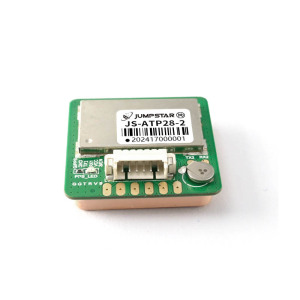
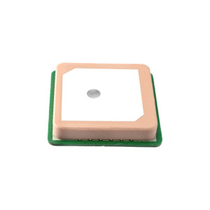
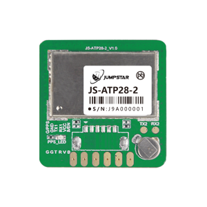
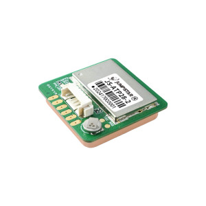
Type Standard Precision GNSS Module Applicable Industry · Automotive Applications: Car navigation and vehicle electronics
· Maritime Navigation & Fleet Management: Ship positioning and maritime dispatch
· Intelligent Logistics Scheduling: Asset tracking and logistics management
· Ground Vehicle Tracking & Urban Intelligent Traffic: Vehicle monitoring and management
· Intelligent Robots: Autonomous navigation and movement control
· Formation Drones: Group flight positioning and navigation
· Personal Travel & Wilderness Exploration: Outdoor positioning and navigation
· Emergency Rescue: Real-time positioning for disaster relief Params Receiver Type Multi-mode single-frequency GNSS positioning module
Supported Constellations & Bands GPS/QZSS L1C/L1C/A; BDS B1I/B1C; GLONASS L1; Galileo E1; SBAS(WAAS/EGNOS/MSAS/GAGAN)
Tracking Channels 47 channels
Sensitivity Tracking & Navigation: -165dBm; Cold Start Acquisition: -148dBm
Time to First Fix Cold Start:24s; Hot Start:1s (all satellites ≥-130dBm)
Positioning Accuracy Vertical:3.75m (open sky, 24h static, >6SVs, CEP 50%)
Time Accuracy 1PPS:10ns
Velocity Accuracy GNSS:0.1m/s; SBAS:0.05m/s (50%@30m/s dynamic operation)
Operational Limits Acceleration ≤4g; Altitude ≤10000m; Velocity ≤100m/s
Baud Rate 4800-921600bps (Default:115200bps)
Max Update Rate 10Hz (Default:1Hz)
Supported Protocols NMEA 0183 V3.01/V4.10 (Input/Output, ASCII)
Antenna Type Built-in passive antenna (25.0×25.0×4.0mm)
Power Supply Voltage VCC:2.8V~5.5V (Typical:5.0V)
Operating Current Acquisition:3138mA@5.0V; Tracking:3035mA@5.0V; Backup:11uA@3.3V
Digital I/O Voltage 2.8V~3.3V
Operating Temperature -40℃ ~ +85℃ (without farad capacitor)
Storage Temperature -40℃ ~ +85℃
Farad Capacitor Temperature -25℃ ~ +60℃ (hot start unavailable outside this range)
Humidity 95%
Mechanical Dimensions 28.0mm × 28.0mm × 7.0mm ±0.3mm
Pin Interfaces GND/PPS, GND, TXD, RXD, VCC, VBAT/EN
Compliance RoHS compliant Scope |
|||||||||
| JS-ARP30-2 | Standard Precision GNSS Module | Plastic + Metal | · Automotive Applications: Vehicle navigation and positioning · Maritime Navigation & Fleet Management: Ship positioning and dispatch · Intelligent Logistics Scheduling: Asset tracking and management · Vehicle Tracking & Fleet Management: Commercial vehicle monitoring · Intelligent Robots: Autonomous navigation and control · Drone Swarm/Formation: Group flight positioning · Personal & Workforce Safety IoT: Personnel safety monitoring · Emergency & Rescue: Real-time positioning for rescue | ||||||
|
Images
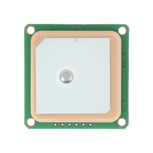
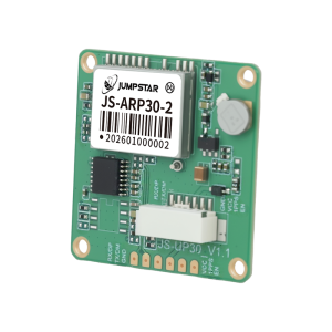
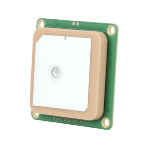
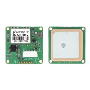
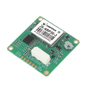
Type Standard Precision GNSS Module Applicable Industry · Automotive Applications: Vehicle navigation and positioning
· Maritime Navigation & Fleet Management: Ship positioning and dispatch
· Intelligent Logistics Scheduling: Asset tracking and management
· Vehicle Tracking & Fleet Management: Commercial vehicle monitoring
· Intelligent Robots: Autonomous navigation and control
· Drone Swarm/Formation: Group flight positioning
· Personal & Workforce Safety IoT: Personnel safety monitoring
· Emergency & Rescue: Real-time positioning for rescue Params Receiver Type Multi-constellation dual-band GNSS positioning module
Supported Constellations & Bands GPS: L1/L5; BDS: B1I/B1C/B2a/B2B/B2I; GLONASS: G1; Galileo: E1/E5; QZSS: L1/L5; NavIC
Tracking Channels 200 tracking channels with dedicated search engine
Sensitivity Tracking & Navigation: -165dBm; Cold Start Acquisition: -148dBm
Time to First Fix Cold Start:28s; AGNSS:2s; Hot Start:1s (all satellites ≥-130dBm)
Positioning Accuracy (CEP 50%) Horizontal:1.0m; Vertical:2.5m (open sky, 24h static, >6SVs)
Velocity Accuracy 0.1m/s (50%@30m/s dynamic operation)
Operational Limits Acceleration ≤4g; Altitude 20000m; Velocity 500m/s
Baud Rate 9600-921600bps (Default:115200bps)
Max Update Rate 10Hz (Default:1Hz)
Supported Protocols NMEA 0183 (Input/Output, ASCII)
Antenna Type Dual-band passive antenna (Default: L5 25×25×4mm stacked on L1 18×18×4mm; Optional: L5 25×25×4mm stacked on L1 18×18×2mm)
Interface Versions Default(UART): JS-ARP30-2; USB: JS-ARP30B-2; RS232: JS-ARP30R-2
Power Supply Voltage VCC:3.3V~5.5V (Typical:5.0V)
Operating Current Acquisition:1830mA@3.3V; Tracking:1828mA@3.3V; Backup:14uA@3.3V
Digital I/O Voltage 3.3V
Operating Temperature -40℃ ~ +85℃ (without farad capacitor)
Storage Temperature -40℃ ~ +85℃
Farad Capacitor Temperature -25℃ ~ +60℃ (hot start unavailable outside this range)
Humidity 95%
Mechanical Dimensions 30.0mm × 30.0mm × 12.5mm ±0.3mm
Pin Interfaces RXD/DP, TXD/DM, GND, VCC, 1PPS, EN
Compliance RoHS compliant Scope |
|||||||||
| JS-ARP28-2 | Stardard Precision GNSS Module | Plastic + Metal + Ceramic | · Drones/UAV: Aerial surveying, autonomous flight positioning · Smart Robotics: Autonomous navigation and precise movement control · Intelligent Logistics Scheduling: Asset tracking and logistics management · Personal Travel & Wilderness Adventure: Outdoor positioning and navigation · Personal Protection: Field staff safety monitoring and positioning · Automotive Application: Vehicle navigation and auxiliary positioning · Wearable Devices: Portable high-precision positioning wearables · Vehicle Navigation & Tracking: Car and fleet positioning management · AVL & Location-Based Services: Automatic vehicle location services · Handheld Receiver Applications: Portable high-sensitivity positioning terminals | ||||||
|
Images
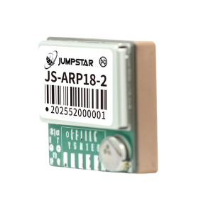
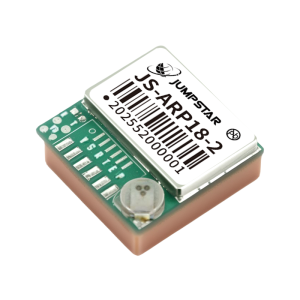
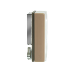
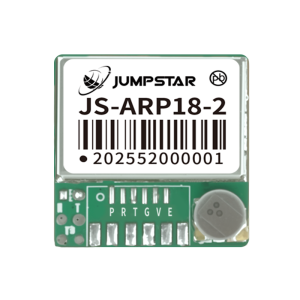
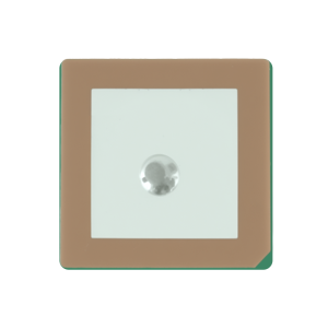
Type Stardard Precision GNSS Module Applicable Industry · Drones/UAV: Aerial surveying, autonomous flight positioning
· Smart Robotics: Autonomous navigation and precise movement control
· Intelligent Logistics Scheduling: Asset tracking and logistics management
· Personal Travel & Wilderness Adventure: Outdoor positioning and navigation
· Personal Protection: Field staff safety monitoring and positioning
· Automotive Application: Vehicle navigation and auxiliary positioning
· Wearable Devices: Portable high-precision positioning wearables
· Vehicle Navigation & Tracking: Car and fleet positioning management
· AVL & Location-Based Services: Automatic vehicle location services
· Handheld Receiver Applications: Portable high-sensitivity positioning terminals Params Receiver Type Dual-band (L1+L5) GNSS high-precision positioning module
Supported Constellations & Bands GPS: L1/L5; BDS: B1I/B1C/B2I/B2B/B2A; GLONASS: G1; Galileo: E1/E5; QZSS: L1/L5; IRNSS: L5; SBAS
Tracking Channels 200 tracking channels with dedicated search engine
Sensitivity Tracking & Navigation: -165dBm; Reacquisition: -159dBm; Warm Start: -159dBm; Cold Start: -148dBm
Time to First Fix Cold Start:28s; AGPS:1.5s; Warm Start:1s (all satellites ≥-130dBm)
Positioning Accuracy (CEP 50%) Single Point: Horizontal 1.0m, Vertical 2.0m (open sky, 24h static, >6SVs)
Time Accuracy PPS: <20ns RMS
Velocity Accuracy 0.1m/s CEP (50%@30m/s dynamic operation)
Operational Limits Dynamics ≤4g; Altitude 20000m; Velocity 500m/s
Baud Rate 9600-2M bps (Default:115200bps)
Max Update Rate 10Hz (Default:1Hz)
Supported Protocols NMEA 0183 (Input/Output, ASCII)
Antenna Type Built-in dual-band passive antennas: L5(25.0×25.0×2.0mm), L1(18.0×18.0×2.0mm)
Power Supply Voltage VCC:3.3V5.5V (Typical:5.0V); Backup:1.8V3.6V (Typical:3.3V)
Operating Current 18~28mA@3.3V (Typical:25mA@3.3V); Backup:14uA@3.3V
Digital IO Voltage 3.3V
Operating Temperature -40℃ ~ +85℃ (without farad capacitor)
Storage Temperature -40℃ ~ +85℃
Farad Capacitor Temperature -25℃ ~ +60℃ (warm start unavailable outside this range)
Humidity 95%
Mechanical Dimensions 28.0mm × 28.0mm × 8.0mm ±0.3mm
Weight <12.0g
Geomagnetic Sensor Options Default:IST8310(0x0F); Optional:QMC5883L(0x0D), VCM5883(0x0C)
Pin Interfaces SCL, SDA, TXD, RXD, GND, VCC
LED Indicator Green LED: Constant light (unlocated); 1Hz flash (located); TXD flash matches data rate
Compliance RoHS compliant Scope |
|||||||||
| JS-AP26-H | Standard Precision GNSS Module | Plastic + Metal | · UAVs: Flight control and positioning navigation · Automotive Application: Car navigation and vehicle tracking · AVL & Location-Based Services: Automatic vehicle location and management · Marine Navigation & Fleet Management: Ship positioning and maritime dispatch · Handheld GPS Receiver: Portable positioning and surveying devices · Intelligent Logistics Scheduling: Asset tracking and logistics management · Personnel Protection: Field staff safety monitoring and positioning · PDA & Pocket PC: Mobile intelligent terminal positioning · Intelligent Robot: Autonomous navigation and movement control | ||||||
|
Images
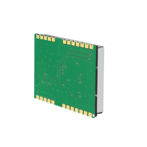
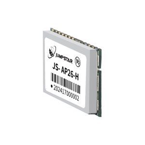
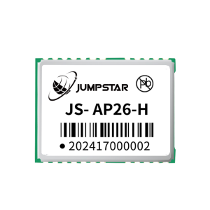
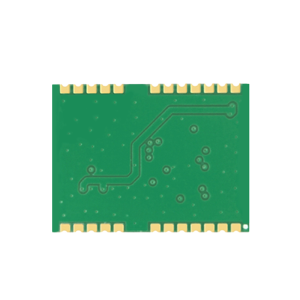
Type Standard Precision GNSS Module Applicable Industry · UAVs: Flight control and positioning navigation
· Automotive Application: Car navigation and vehicle tracking
· AVL & Location-Based Services: Automatic vehicle location and management
· Marine Navigation & Fleet Management: Ship positioning and maritime dispatch
· Handheld GPS Receiver: Portable positioning and surveying devices
· Intelligent Logistics Scheduling: Asset tracking and logistics management
· Personnel Protection: Field staff safety monitoring and positioning
· PDA & Pocket PC: Mobile intelligent terminal positioning
· Intelligent Robot: Autonomous navigation and movement control Params Receiver Type Single-frequency multi-mode GNSS positioning module
Supported Constellations & Bands GPS/QZSS L1C/A; BDS B1I/B1C; GLONASS L1; Galileo E1; SBAS(WAAS/EGNOS/MSAS/GAGAN/SDCM)
Sensitivity Tracking & Navigation: -162dBm; Reacquisition: -159dBm; Cold Start: -148dBm
Time to First Fix Cold Start:28s; Hot Start:1s (all satellites ≥-130dBm)
Positioning Accuracy (CEP 50%) GNSS:2.5m; SBAS:2.0m; D-GNSS:1.0m (open sky, 24h static, >6SVs)
Time Accuracy 1PPS:25ns
Velocity Accuracy GNSS:0.1m/s; SBAS/D-GNSS:0.05m/s
Operational Limits Altitude 18000m; Velocity 515m/s; Dynamics <4g
Baud Rate 9600~460800bps (Default:9600bps)
Max Update Rate 10Hz (Default:1Hz)
Supported Protocols NMEA 0183 V4.00/V4.10 (Input/Output, ASCII)
Interfaces UART, I2C, USB 2.0 FS, PPS, RF_IN, Main/Backup Power, Reset
Antenna Compatibility Passive & Active Antenna; Active Antenna: Gain 15~30dB, Noise Figure ≤1.5dB
Power Supply Voltage VCC:1.8V3.6V (Typical:3.3V); Backup:1.6V3.6V (Typical:3.3V); USB:3.0V~3.6V
Operating Current Acquisition:3845mA@3.3V; Tracking:3843mA@3.3V; Backup:9uA@3.3V
Digital IO Voltage 1.7V~3.6V
Operating/Storage Temperature -40℃ ~ +85℃
Humidity 95%
Mechanical Dimensions 16.0mm × 12.2mm × 2.4mm ±0.3mm
Compliance RoHS compliant Scope |
|||||||||
| JS-AP10-H | Standard Precision GNSS Module | Plastic + Metal | · UAVs: Flight control and positioning navigation · Automotive Application: Car navigation and vehicle tracking · AVL & Location-Based Services: Automatic vehicle location and management · Marine Navigation & Fleet Management: Ship positioning and maritime dispatch · Handheld GPS Receiver: Portable positioning and surveying devices · Intelligent Logistics Scheduling: Asset tracking and logistics management · Personnel Protection: Field staff safety monitoring and positioning · PDA & Pocket PC: Mobile intelligent terminal positioning · Intelligent Robot: Autonomous navigation and movement control | ||||||
|
Images
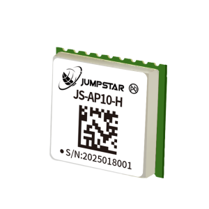
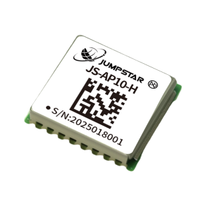
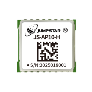
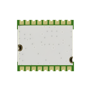
Type Standard Precision GNSS Module Applicable Industry · UAVs: Flight control and positioning navigation
· Automotive Application: Car navigation and vehicle tracking
· AVL & Location-Based Services: Automatic vehicle location and management
· Marine Navigation & Fleet Management: Ship positioning and maritime dispatch
· Handheld GPS Receiver: Portable positioning and surveying devices
· Intelligent Logistics Scheduling: Asset tracking and logistics management
· Personnel Protection: Field staff safety monitoring and positioning
· PDA & Pocket PC: Mobile intelligent terminal positioning
· Intelligent Robot: Autonomous navigation and movement control Params Receiver Type Single-frequency multi-mode GNSS positioning module
Supported Constellations & Bands GPS L1C/A; BDS B1I/B1C; Galileo E1B/C; SBAS L1C/A; QZSS L1C/A
Sensitivity Tracking & Navigation: -162dBm; Reacquisition: -159dBm; Cold Start: -148dBm
Time to First Fix Cold Start:28s; Hot Start:1s (all satellites ≥-130dBm)
Positioning Accuracy (CEP 50%) GNSS:2.5m; SBAS:2.0m; D-GNSS:1.0m (open sky, 24h static, >6SVs)
Time Accuracy 1PPS:25ns RMS
Velocity Accuracy GNSS:0.1m/s; SBAS/D-GNSS:0.05m/s
Operational Limits Dynamics ≤4g; Altitude 18000m; Velocity 515m/s
Baud Rate 9600~460800bps (Default:9600bps)
Max Update Rate 10Hz (Default:1Hz)
Supported Protocols NMEA 0183 V4.00/V4.10 (Input/Output, ASCII)
Antenna Compatibility Passive & Active Antenna; Active Antenna: Gain 15~30dB, Noise Figure ≤1.5dB
Power Supply Voltage VCC:1.8V3.6V (Typical:3.3V); Backup:1.6V3.6V (Typical:3.3V)
Operating Current Acquisition:2024mA@3.3V; Tracking:1822mA@3.3V; Backup:12uA@3.3V
Digital IO Voltage 1.8V~3.6V
Operating/Storage Temperature -40℃ ~ +85℃
Humidity 95%
Mechanical Dimensions 10.5mm × 9.7mm × 2.3mm ±0.3mm
Pin Interfaces GND, TXD, RXD, 1PPS, V_backup, VCC, RESET, RF_IN, VCC_RF
Compliance RoHS compliant Scope |
|||||||||
| JS-AP08-PR | Mini Size GNSS Module | Plastic + Metal | · Smart Wearable Devices: Portable positioning wearables and health trackers · Fleet Management: Vehicle positioning, monitoring and dispatch · Portable Positioning Devices: Handheld mini positioning terminals · Tracker: Asset and personal tracking devices · Vehicle Navigation: Car and small vehicle navigation systems · Personnel Location: Field staff positioning and safety monitoring | ||||||
|
Images
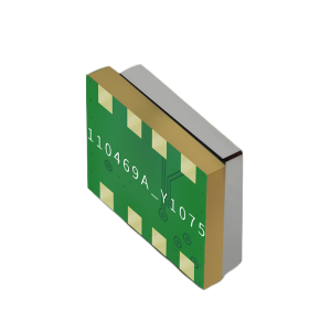
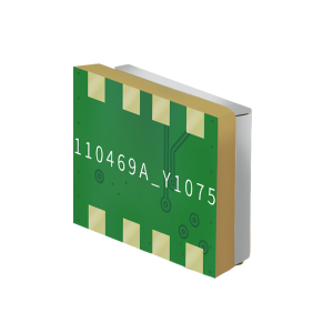
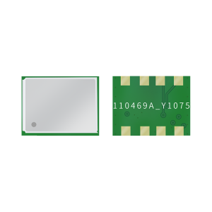
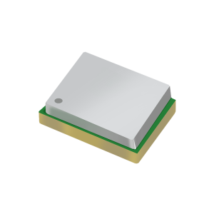
Type Mini Size GNSS Module Applicable Industry · Smart Wearable Devices: Portable positioning wearables and health trackers
· Fleet Management: Vehicle positioning, monitoring and dispatch
· Portable Positioning Devices: Handheld mini positioning terminals
· Tracker: Asset and personal tracking devices
· Vehicle Navigation: Car and small vehicle navigation systems
· Personnel Location: Field staff positioning and safety monitoring Params Receiver Type Mini size single-frequency dual-mode GNSS positioning module
Supported Constellations & Bands GPS/QZSS: L1C/A; BDS: B1I, B1C
Core Processor ARM Cortex-M4F
Tracking Channels 88 tracking channels with dedicated search engine
Sensitivity Tracking & Navigation: -161dBm; Reacquisition: -158dBm; Cold Start: -148dBm; Hot Start: -156dBm
Time to First Fix Cold Start:29s; Hot Start:1s (all satellites ≥-130dBm)
Positioning Accuracy (CEP 50%) GNSS: 2.5m (open sky, 24h static, >6SVs)
Time Accuracy 1PPS: 20ns
Velocity Accuracy 0.1m/s CEP (50%@30m/s dynamic operation)
Operating Limits Altitude:18000m; Velocity:515m/s
Baud Rate 9600bps
Max Update Rate Default 1Hz, configurable up to 5Hz
Supported Protocols NMEA 0183 V4.10 (Input/Output, ASCII; Output sentences: GGA, GSA, GSV, RMC, ZDA, TXT)
Power Supply Voltage VCC:1.9V-3.6V (Typical:3.3V); Backup:V_BACKP=3.3V
Operating Current 20mA-25mA@3.3V (Typical:21mA@3.3V)
IO Voltage 1.8V-3.6V
Operating/Storage Temperature -40℃ ~ +85℃
Humidity 95%
Mechanical Dimensions 8.0mm × 6.0mm × 2.3mm ±0.1mm
Weight <1g
Pin Interfaces RF-IN, GND, GPS_RX, GPS_TX, V_BACKP, 32K_IN, VCC
Compliance RoHS compliant Scope |
|||||||||
| JS-AD56UB8 | Standard Precision GNSS Module for UAV | Plastic + Metal + Ceramic | · UAVs: Flight control and positioning navigation · Automotive Applications: Car navigation and vehicle tracking · AVL & Location-Based Services: Automatic vehicle location and management · Marine Navigation & Fleet Management: Ship positioning and maritime dispatch · Handheld GPS Receivers: Portable positioning and surveying devices · Intelligent Logistics Scheduling: Asset tracking and logistics management · Personnel Protection: Field staff safety monitoring and positioning · PDA & Pocket PC: Mobile intelligent terminal positioning · Intelligent Robots: Autonomous navigation and movement control | ||||||
|
Images
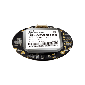
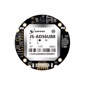
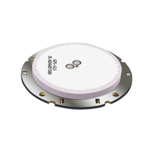
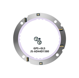
Type Standard Precision GNSS Module for UAV Applicable Industry · UAVs: Flight control and positioning navigation
· Automotive Applications: Car navigation and vehicle tracking
· AVL & Location-Based Services: Automatic vehicle location and management
· Marine Navigation & Fleet Management: Ship positioning and maritime dispatch
· Handheld GPS Receivers: Portable positioning and surveying devices
· Intelligent Logistics Scheduling: Asset tracking and logistics management
· Personnel Protection: Field staff safety monitoring and positioning
· PDA & Pocket PC: Mobile intelligent terminal positioning
· Intelligent Robots: Autonomous navigation and movement control Params Receiver Type Multi-mode multi-GNSS high-sensitivity positioning module
Supported Constellations & Bands GPS L1C/A; BDS B1I; GLONASS L1OF; Galileo E1B/C; SBAS L1C/A; QZSS L1C/A
Core Chip U8 high-performance GNSS chip
Correlators Over 2 million effective correlators
Channels 72 search mode channels, 24 capture channels
Sensitivity Tracking & Navigation: -167dBm; Reacquisition: -160dBm; Cold Start: -148dBm
Time to First Fix Cold Start:26s; Hot Start:1s (all satellites ≥-130dBm)
Positioning Accuracy (CEP 50%) Autonomous:2.5m; SBAS:2.0m (open sky, 24h static, >6SVs)
Time Accuracy 1PPS:30ns RMS
Velocity Accuracy 0.05m/s (50%@30m/s dynamic operation)
Operational Limits Dynamics ≤4g; Altitude 50000m; Velocity ≤500m/s
Baud Rate 9600-460800bps (Default:9600bps)
Max Update Rate 10Hz (Default:1Hz)
Supported Protocols NMEA 0183 V4.0/V4.1 (I/O, ASCII); UBX (I/O, binary proprietary)
Antenna Type Passive antenna (Default:φ44×4mm)
Power Supply Voltage 4.5V-12V (Typical:5.0V)
Operating Current Acquisition:66-72mA@5.0V; Tracking:62-68mA@5.0V
Digital IO Voltage 3.3V
Operating Temperature -40℃ to 85℃ (without Farad capacitor)
Storage Temperature -40℃ to 85℃
Farad Capacitance Temperature -25℃ to 60℃ (hot start unavailable outside this range)
Humidity 95%
Mechanical Dimensions φ56mm×8.9mm ±0.5mm
Optional Sensors Magnetometer(IST8310/VCM5883), Barometer(MS5611), MCU(STM32F103CBT6)
Interface Versions JS-AD56UB8-C(CAN); JS-AD56UB8-T(TTL); JS-AD56UB8-M(TTL+MCU); JS-AD56UB8-S(TTL+Barometer)
Compliance RoHS compliant Scope |
|||||||||
| JS-UK40 | High Precision RTK GNSS Module | Plastic + Metal | · Handheld Terminals: High-precision mobile positioning and surveying devices · UAVs: Aerial surveying, mapping and autonomous flight positioning · Agricultural Automation: Precision agricultural machinery and unmanned farming · Intelligent Robots: Autonomous navigation and precise movement control · Aided Driving: Vehicle high-precision positioning and assisted navigation · Vehicle Management: Fleet positioning, monitoring and dispatch · Wisdom Construction Sites: Site personnel and equipment positioning · Intelligent Safety Testing: Real-time safety monitoring and positioning · Smart Cities: Urban infrastructure positioning and management | ||||||
|
Images
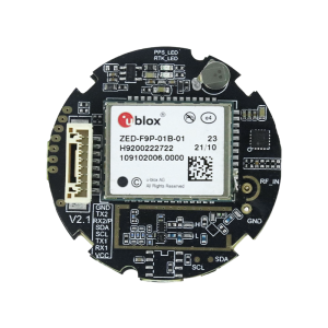
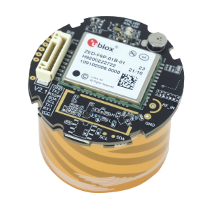
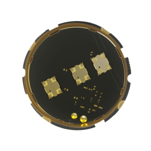
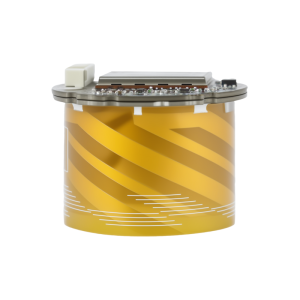
Type High Precision RTK GNSS Module Applicable Industry · Handheld Terminals: High-precision mobile positioning and surveying devices
· UAVs: Aerial surveying, mapping and autonomous flight positioning
· Agricultural Automation: Precision agricultural machinery and unmanned farming
· Intelligent Robots: Autonomous navigation and precise movement control
· Aided Driving: Vehicle high-precision positioning and assisted navigation
· Vehicle Management: Fleet positioning, monitoring and dispatch
· Wisdom Construction Sites: Site personnel and equipment positioning
· Intelligent Safety Testing: Real-time safety monitoring and positioning
· Smart Cities: Urban infrastructure positioning and management Params Receiver Type Multi-band concurrent GNSS RTK helical antenna module
Supported Constellations & Bands GPS/QZSS/SBAS: L1C/A, L2C; Galileo: E1, E5b; GLONASS: L1OF, L2OF; BDS: B1I, B2I
Channels 192 search channels, 60 tracking channels
Sensitivity Tracking: -167dBm; Reacquisition: -148dBm; Cold Start Acquisition: -148dBm
Time to First Fix Cold Start:25s; Warm Start:20s; Hot Start:2s (all satellites ≥-130dBm)
Positioning Accuracy PVT:1.5m CEP; SBAS:1.0m CEP; RTK:2cm+1ppm (Horizontal, ≤30km baseline)
Time Accuracy 1PPS:30ns RMS
Velocity Accuracy 0.05m/s (50%@30m/s dynamic operation)
Operational Limits Dynamics ≤4g; Altitude 80000m; Velocity 500m/s
Baud Rate 9600-921600bps (Default:38400bps)
Max Update Rate GPS RTK:20Hz; GNSS RTK:7Hz
Supported Protocols NMEA 0183(V4.11/V4.10/V4.0/V2.3/V2.1), RTCM3.3, UBX(Proprietary)
Antenna Type Active helical antenna; Default passive size:φ35mm, height 25mm
Power Supply Voltage 3.3V-5.5V (Typical:5.0V)
Operating Current Acquisition:110-140mA@5.0V; Tracking:110-130mA@5.0V
Digital IO Voltage 3.3V
Operating Temperature -40℃ to 85℃ (without Farad capacitor)
Storage Temperature -40℃ to 85℃
Farad Capacitance Temperature -25℃ to 60℃ (hot start unavailable outside this range)
Humidity 95%
Mechanical Dimensions Bottom diameter:39.80mm; Top diameter:35.00mm; Height:32.00mm ±0.3mm
Geomagnetic Sensor Options Default:IST8310(0x0F); Optional:VCM5883(0x0C), QMC5883L(0x0D)
Interfaces Dual UART (UART1/UART2), I2C (SDA/SCL), PPS, VCC, GND
Compliance RoHS compliant Scope |
|||||||||
| JS-SK40 | High Precision RTK GNSS Module | Plastic + Metal | · UAV/Drones: Autonomous flight, aerial surveying and mapping · Automotive Applications: Intelligent driving and high-precision vehicle positioning · Precision Agriculture: Auto-steering agricultural machinery and precision operation · Marine Navigation: Ship positioning and maritime fleet management · Logistics & Security: Asset tracking and cargo security monitoring · Surveying & Mapping: Professional geographic survey and topographic data collection · Robotics: Autonomous navigation and precise movement control · Smart Ports: Automated terminal operation and container positioning · Power Grid & Electricity: Power facility inspection and grid positioning · Smart Transportation: Intelligent traffic monitoring and management | ||||||
|
Images
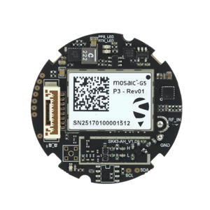
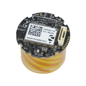
Type High Precision RTK GNSS Module Applicable Industry · UAV/Drones: Autonomous flight, aerial surveying and mapping
· Automotive Applications: Intelligent driving and high-precision vehicle positioning
· Precision Agriculture: Auto-steering agricultural machinery and precision operation
· Marine Navigation: Ship positioning and maritime fleet management
· Logistics & Security: Asset tracking and cargo security monitoring
· Surveying & Mapping: Professional geographic survey and topographic data collection
· Robotics: Autonomous navigation and precise movement control
· Smart Ports: Automated terminal operation and container positioning
· Power Grid & Electricity: Power facility inspection and grid positioning
· Smart Transportation: Intelligent traffic monitoring and management Params Receiver Type Multi-system multi-frequency high-precision RTK GNSS helical antenna module
Supported Constellations & Bands BDS: B1I/B1C/B2a/B2I/B2b/B3I; GPS: L1C/A/L1C/L2PY/L2C/L5; GLONASS: L1CA/L2CA/L2P/L3 CDMA; Galileo: E1/E5a/E5b/E6; QZSS: L1C/A/L1C/B/L2C/L5/L6*
Channels 789 hardware super channels
Time to First Fix Cold Start:35s; Hot Start:10s; Reacquisition:1s; RTK Initialization:7s (baseline<30km)
Sensitivity Tracking: -150dBm (20dB-Hz); Acquisition: -140dBm (30dB-Hz)
Positioning Accuracy (RMS) 3D: Horizontal 1.5m, Vertical 2m; DGNSS: Horizontal 0.4m, Vertical 0.7m; RTK: Horizontal 0.6cm+0.5ppm, Vertical 1cm+1ppm (24h static, ≥15 satellites)
Time Accuracy PPS:1.4ns RMS; Event:<3ns; Latency:<10ms (99.9%)
Velocity Accuracy 3cm/s
Max Data Update Rate 20Hz
Baud Rate 4800-4M bps (Default:115200bps)
Supported Protocols NMEA 0183(v2.3/v3.0/v4.0), SBF (Proprietary), RTCM3.X (MSM included)
Antenna Configuration Dual antenna: built-in active antenna + external MMCX antenna; Antenna bias:3.0-5.5V (150mA current limit); Gain:15~35dB
Power Supply Voltage 4.8V-5.5V (Typical:5.0V)
Operating Current Acquisition:135mA-180mA@5.0V; Tracking:123mA-170mA@5.0V
Operating Temperature -40℃ to 85℃
Storage Temperature -45℃ to 85℃
Humidity 95%
Mechanical Dimensions 39.80mm×35.00mm×32.41mm ±0.3mm
Weight <10.2g
Geomagnetic Sensor Options Default:IST8310(0x0F); Optional:VCM5883(0x0C), QMC5883L(0x0D)
Interfaces Dual UART (UART1/UART2), I2C (SDA/SCL), PPS, MMCX RF connector
Compliance RoHS compliant Scope |
|||||||||
| JS-RK40 | High Precision RTK GNSS Module | Plastic + Metal | · UAV/Drones: Autonomous flight, aerial surveying and mapping · Robotics: Autonomous navigation and precise movement control · Wearable Devices: Portable high-precision positioning terminals · Smart Logistics Dispatching: Asset tracking and logistics management · Car Navigation and Tracking: Vehicle positioning and fleet management · Power Grid & Electricity: Power facility inspection and positioning · Precision Agriculture: Agricultural machinery auto-steering and precision operation · Logistics Security: Cargo tracking and security monitoring · Handheld Terminals: Mobile surveying and positioning devices · Smart Transportation: Intelligent traffic monitoring and management | ||||||
|
Images
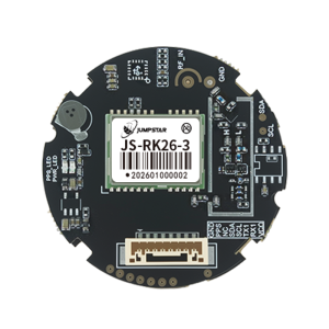
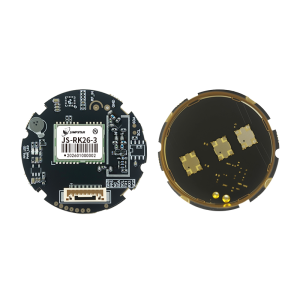
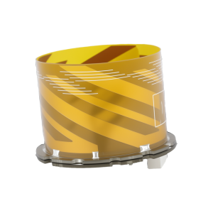
Type High Precision RTK GNSS Module Applicable Industry · UAV/Drones: Autonomous flight, aerial surveying and mapping
· Robotics: Autonomous navigation and precise movement control
· Wearable Devices: Portable high-precision positioning terminals
· Smart Logistics Dispatching: Asset tracking and logistics management
· Car Navigation and Tracking: Vehicle positioning and fleet management
· Power Grid & Electricity: Power facility inspection and positioning
· Precision Agriculture: Agricultural machinery auto-steering and precision operation
· Logistics Security: Cargo tracking and security monitoring
· Handheld Terminals: Mobile surveying and positioning devices
· Smart Transportation: Intelligent traffic monitoring and management Params Receiver Type Dual-band (L1/L5) high-precision GNSS helical antenna module
Supported Constellations & Bands GPS: L1/L5; BDS: B1I/B1C/B2I/B2B/B2A; Galileo: E1/E5; GLONASS: G1; QZSS: L1/L5; IRNSS: L5; SBAS
Tracking Channels 200
Sensitivity Tracking: -165dBm; Reacquisition: -159dBm; Hot Start: -159dBm; Cold Start: -148dBm
Time to First Fix Cold Start:28s; AGPS:1.5s; Hot Start:1s (all satellites ≥-130dBm)
Positioning Accuracy (CEP 50%) Single Point: Horizontal 1.0m, Vertical 2.0m; RTK: Horizontal 1.0cm+1ppm, Vertical 1.5cm+1ppm
Time Accuracy PPS: <20ns RMS
Velocity Accuracy 0.1m/s CEP (50%@30m/s dynamic operation)
Operating Limits Dynamics ≤4g; Altitude 20000m; Velocity 500m/s
Baud Rate 115200-921600bps (Default:115200bps)
Max Update Rate 10Hz (Default:1Hz)
Supported Protocols NMEA 0183 (I/O, ASCII); RTCM3.X (I/O)
Working Modes Rover mode & Base Station mode
Antenna Type Active helical antenna (Φ35.00mm, Height 25.00mm)
Power Supply Voltage 3.3V-5.5V (Typical:5.0V)
Operating Current 45mA-65mA@5.0V (Typical:58mA@5.0V)
Backup Power Voltage:1.8V-3.6V; Current:14uA@3.3V
Operating Temperature -40℃ to 70℃ (without Farad capacitor)
Storage Temperature -40℃ to 70℃
Farad Capacitor Temperature -25℃ to 60℃ (hot start unavailable outside this range)
Humidity 95%
Mechanical Dimensions Bottom:Φ39.80mm; Top:Φ35.00mm; Height:32.00mm
Weight <10.20g
Geomagnetic Sensor Options Default:IST8310(0x0F); Optional:VCM5883(0x0C), QMC5883L(0x0D)
Interfaces UART1 (TX1/RX1), I2C (SDA/SCL), PPS, VCC, GND
Compliance RoHS compliant Scope |
|||||||||
| JS-RK26-3 | High Precision RTK GNSS Module | Plastic + Metal | · Emergency Rescue: Real-time positioning and rescue command · Automotive Application: Vehicle navigation, tracking and fleet management · AVL & Location-Based Services: Automatic vehicle location and location services · Maritime Navigation: Ship positioning and maritime fleet dispatch · Intelligent Logistics Scheduling: Asset tracking and logistics management · Personnel Protection: Field staff real-time positioning and safety monitoring · Handheld Devices: PDA, laptop and portable positioning terminals · UAVs: Aerial surveying, autonomous flight and precise positioning | ||||||
|
Images
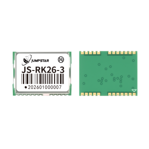
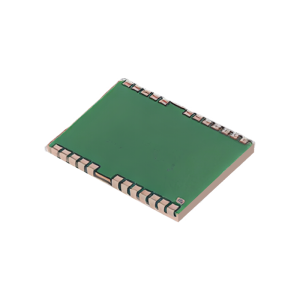
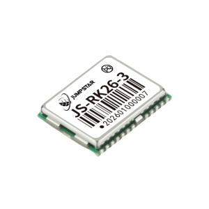
Type High Precision RTK GNSS Module Applicable Industry · Emergency Rescue: Real-time positioning and rescue command
· Automotive Application: Vehicle navigation, tracking and fleet management
· AVL & Location-Based Services: Automatic vehicle location and location services
· Maritime Navigation: Ship positioning and maritime fleet dispatch
· Intelligent Logistics Scheduling: Asset tracking and logistics management
· Personnel Protection: Field staff real-time positioning and safety monitoring
· Handheld Devices: PDA, laptop and portable positioning terminals
· UAVs: Aerial surveying, autonomous flight and precise positioning Params Receiver Type Dual-band (L1/L5) high-precision GNSS positioning module
Supported Constellations & Bands GPS: L1/L5; BDS: B1I/B1C/B2I/B2B/B2A; Galileo: E1/E5; GLONASS: G1; QZSS: L1/L5; IRNSS: L5; SBAS
Tracking Channels 200
Sensitivity Tracking & Navigation: -165dBm; Reacquisition: -159dBm; Warm Start: -159dBm; Cold Start: -148dBm
Time to First Fix Cold Start: 28s; Warm Start: 1s (all satellites ≥-130dBm)
Positioning Accuracy (CEP 50%) Standalone: Horizontal 1.5m, Vertical 2.5m; RTK: Horizontal 1.0cm+1ppm, Vertical 1.5cm+1ppm
Velocity Accuracy 0.1m/s CEP (50%@30m/s dynamic operation)
Timing Accuracy PPS: 20ns RMS
Operating Limits Dynamics ≤4g; Altitude 18000m; Velocity 515m/s
Baud Rate 115200~921600bps (Default: 115200bps)
Max Update Rate 20Hz (Default: 1Hz)
Supported Protocols NMEA 0183 (Input/Output, ASCII); RTCM3.X (Input/Output)
Power Supply Voltage VCC: 2.0V~3.6V (Typical: 3.3V); V_BACK: 1.8V~3.6V (Typical: 3.3V)
Operating Current 16mA~30mA@3.3V (Typical: 20mA@3.3V); Standby: 14uA@3.3V
Digital IO Voltage 1.8V~3.6V
Operating/Storage Temperature -40℃ ~ +85℃
Humidity 95%
Mechanical Dimensions 16.2mm × 12.2mm × 2.3mm ±0.3mm
Antenna Requirements Active Antenna: Min Gain 15dB, Max Gain 30dB, Max Noise Factor 1.5dB; Compatible with Passive Antenna
Compliance RoHS compliant Scope |
|||||||||
| JS-NK40 | High Precision RTK GNSS Module | Plastic + Metal + Ceramic | · UAV/Drones: Autonomous flight, aerial surveying and mapping · Automotive Applications: Intelligent driving and vehicle positioning · Precision Agriculture: Auto-steering agricultural machinery and precision operation · Handheld Devices: High-precision mobile positioning terminals · Logistics Security: Asset tracking and security monitoring · Surveying and Mapping: Geographic survey and topographic data collection · Robotics: Autonomous navigation and precise movement · Smart Ports: Automated terminal operation and container positioning · Electric Power Grid: Power facility inspection and grid positioning · Smart Transportation: Traffic monitoring and intelligent vehicle management | ||||||
|
Images
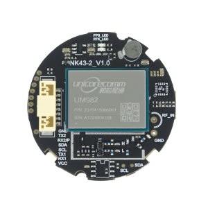
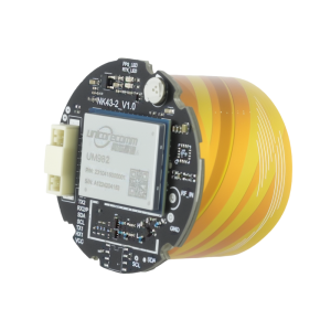
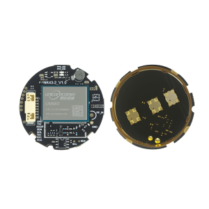
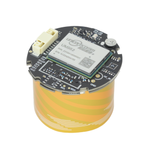
Type High Precision RTK GNSS Module Applicable Industry · UAV/Drones: Autonomous flight, aerial surveying and mapping
· Automotive Applications: Intelligent driving and vehicle positioning
· Precision Agriculture: Auto-steering agricultural machinery and precision operation
· Handheld Devices: High-precision mobile positioning terminals
· Logistics Security: Asset tracking and security monitoring
· Surveying and Mapping: Geographic survey and topographic data collection
· Robotics: Autonomous navigation and precise movement
· Smart Ports: Automated terminal operation and container positioning
· Electric Power Grid: Power facility inspection and grid positioning
· Smart Transportation: Traffic monitoring and intelligent vehicle management Params Receiver Type Multi-system multi-frequency high-precision RTK GNSS helical antenna module
Supported Constellations & Bands BDS B1I/B2I/B3I; GPS L1C/A/L2P(Y)/L2C/L5; GLONASS L1/L2; Galileo E1/E5a/E5b; QZSS L1/L2/L5; SBAS
Channels 1408 super channels
Time to First Fix Cold start <30s (-130dBm, ≥12 satellites)
Positioning Accuracy (RMS) 3D: Horizontal 1.5m, Vertical 2.5m; DGPS: Horizontal 0.4m+1ppm, Vertical 0.8m+1ppm; RTK: Horizontal 1.5cm+1ppm, Vertical 2.0cm+1ppm
Time Accuracy 20ns (RMS)
Velocity Accuracy 0.03m/s (RMS, 99%@static open sky)
RTK Initialization Time <5s (typical)
Baud Rate 9600-921600bps (Default: 115200bps)
Max Data Update Rate 20Hz
Supported Protocols Data: NMEA 0183, Unicore; Differential: RTCM3.X
Antenna Type Active helical antenna (φ35mm, Height 25mm)
Power Supply Voltage 3.3V-5.5V (Typical: 5.0V)
Operating Current 180mA-310mA @3.3V (Typical: 220mA @3.3V)
VCC Ripple ≤50mV
Operating Temperature -40℃ to 85℃ (without Farad capacitor)
Storage Temperature -40℃ to 85℃
Farad Capacitor Temperature -25℃ to 60℃ (hot start unavailable outside this range)
Humidity 95%
Mechanical Dimensions 39.80mm×35.00mm×32.0mm ±0.3mm
Weight <10.2g
Geomagnetic Sensor Options Default: IST8310 (0x0F); Optional: VCM5883 (0x0C), QMC5883L (0x0D)
Compliance RoHS compliant Scope |
|||||||||
| JS-M6D | High Precision RTK GNSS Module | Plastic + Metal + Ceramic | · UAVs: Aerial surveying, mapping and autonomous flight positioning · Precision Agriculture: Automatic steering of agricultural machinery and precision operation · Marine Navigation & Fleet Management: Ship positioning and maritime dispatch · Intelligent Logistics Scheduling: Asset tracking and logistics vehicle management · Personnel Protection: Real-time positioning of field staff · Handheld Devices: PDA, Pocket PC and handheld GPS receivers · Geographic Surveying & Mapping: Professional surveying and topographic data collection · Automotive Applications: Car navigation, tracking and driving test systems · AVL & Location-Based Services: Automatic vehicle location and location services · Intelligent Robots: Autonomous navigation and precise movement control | ||||||
|
Images
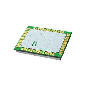
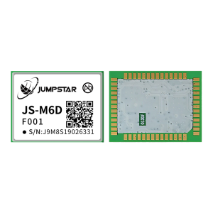
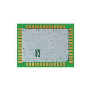
Type High Precision RTK GNSS Module Applicable Industry · UAVs: Aerial surveying, mapping and autonomous flight positioning
· Precision Agriculture: Automatic steering of agricultural machinery and precision operation
· Marine Navigation & Fleet Management: Ship positioning and maritime dispatch
· Intelligent Logistics Scheduling: Asset tracking and logistics vehicle management
· Personnel Protection: Real-time positioning of field staff
· Handheld Devices: PDA, Pocket PC and handheld GPS receivers
· Geographic Surveying & Mapping: Professional surveying and topographic data collection
· Automotive Applications: Car navigation, tracking and driving test systems
· AVL & Location-Based Services: Automatic vehicle location and location services
· Intelligent Robots: Autonomous navigation and precise movement control Params Receiver Type Multi-frequency multi-mode RTK high-precision GNSS positioning module
Supported Constellations & Frequency Bands GPS/QZSS: L1, L2; GLONASS: G1, G2; BDS: B1I, B2I (Beidou-3 supported); Galileo: E1, E5b
Search/Tracking Channels 96 search channels, 60 tracking channels
Sensitivity Tracking & Navigation: -163dBm; Reacquisition: -147dBm
Time to First Fix Cold Start: ≤35s; Cold Start (AGNSS): ≤3s; Hot Start: ≤1s; Reacquisition: ≤1s
Positioning Accuracy (CEP 50%) 3D: 2.0m; D-GNSS: 0.5m; RTK (Horizontal): 2cm+1ppm (≤30km baseline)
Timing Accuracy 1PPS: 20ns
Velocity Accuracy 0.05m/s (50%@30m/s dynamic operation)
Operational Limits Dynamics: ≤4g; Altitude: 18000m; Velocity: 515m/s
Baud Rate 9600-230400bps (Default: 115200bps)
Max Navigation Update Rate 10Hz (customizable on request)
Supported Protocols NMEA 0183, RTCM3.x, JMS (Custom)
Power Supply (VCC) 3.0V-3.6V (Typical: 3.3V)
Operating Current Typical: 105mA @3.3V; Peak: 130mA @3.3V
Backup Power (V_BKUP) 1.8V-3.6V; RTC Current: 10-13uA
ESD Protection 2000V (HBM, all pins); MSL Level 3
Operating Temperature -40℃ ~ +85℃
Storage Temperature -45℃ ~ +85℃
Mechanical Dimensions 22.0mm×17.0mm×2.4mm ±0.2mm (LGA package)
Antenna Features Supports antenna open/short circuit detection, antenna power supply control
Compliance RoHS compliant Scope |
|||||||||
| JS-ARK37-3 | High Precision RTK GNSS Module | Plastic + Metal + Ceramic | · UAV/Drones: Aerial surveying, autonomous flight and precise positioning · Smart Logistics Dispatch: Asset tracking and efficient logistics management · Autonomous Driving: Vehicle positioning and autonomous navigation · Precision Agriculture & Location Services: High-precision agricultural machinery control · Surveying and Mapping: Geographic survey and topographic data collection · Autonomous Robots: Inspection robots and mobile robot navigation · In-vehicle Applications: Automotive navigation and fleet positioning · Precision Control: Industrial equipment and precision motion control | ||||||
|
Images
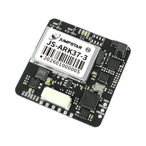
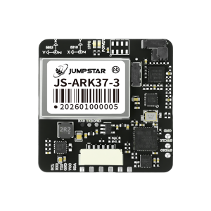
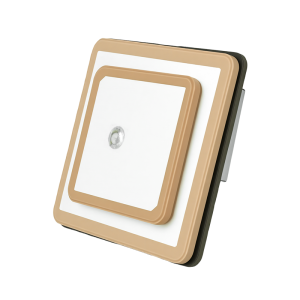
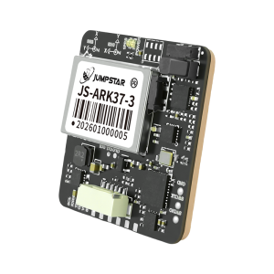
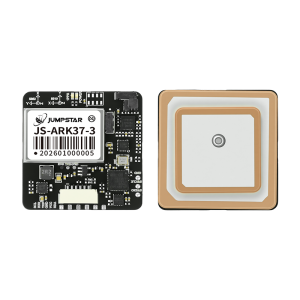
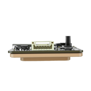
Type High Precision RTK GNSS Module Applicable Industry · UAV/Drones: Aerial surveying, autonomous flight and precise positioning
· Smart Logistics Dispatch: Asset tracking and efficient logistics management
· Autonomous Driving: Vehicle positioning and autonomous navigation
· Precision Agriculture & Location Services: High-precision agricultural machinery control
· Surveying and Mapping: Geographic survey and topographic data collection
· Autonomous Robots: Inspection robots and mobile robot navigation
· In-vehicle Applications: Automotive navigation and fleet positioning
· Precision Control: Industrial equipment and precision motion control Params Receiver Type Full-system dual-frequency high-precision RTK GNSS antenna module
Constellations & Frequency Bands GPS/QZSS:L1,L5; GLONASS:G1; Galileo:E1,E5; BDS:B1I,B1C,B2a,B2b,B2I; IRNSS:L5; SBAS
Tracking Channels 200
Sensitivity Cold Start: -148dBm; Hot Start & Reacquisition: -159dBm; Tracking: -165dBm
Time to First Fix Cold Start:28s; Hot Start:1s; AGPS:1.5s (all satellites at -130dBm)
Positioning Accuracy (CEP 50%) Single Point: Horizontal 1.0m, Vertical 2.0m; RTK: Horizontal 1.0cm+1ppm, Vertical 1.5cm+1ppm
Velocity Accuracy 0.1m/s CEP
Timing Accuracy 1PPS output <20ns(RMS)
Max Data Update Rate 10Hz (default 1Hz)
Operating Limits Max Acceleration:≤4g; Max Velocity:≤500m/s; Max Altitude:20000m
Supported Protocols NMEA-0183, RTCM 3.X, Custom Binary
Power Supply Voltage 3.5V-12.0V (Typical:5V)
Operating Current 42mA-53mA@5V (≈+8mA when using CAN protocol)
Operating Temperature -40℃ to 85℃ (without Farad capacitor)
Storage Temperature -40℃ to 85℃
Humidity 95%rh (Non-condensing)
Mechanical Dimensions 36.00×36.00×9.70mm ±0.2mm
Weight <21g
Antenna Type Passive antenna (Default:L1 25252mm, L5 35352mm; Optional:L1 25254mm, L5 35354mm)
Magnetometer Options Default:IST8310(0x0F); Optional:VCM5883(0x0C), QMC5883L(0x0D), RM3100(0x20)
Interface Configurations Default:TTL; Optional:RS232/CAN; Magnetometer:Optional
Connector GH--6PIN-1.25MM (customizable)
Compliance RoHS Scope |
|||||||||
| JS-ARK28-3 | High Precision RTK GNSS Module | Plastic + Metal + Ceramic | · UAV/Drones: Aerial surveying, autonomous flight and precise positioning · Automotive Navigation and Tracking: Vehicle positioning, navigation and fleet management · Smart Robots: Autonomous navigation and precise movement control · Wearable Devices: Personal positioning and safety monitoring · Intelligent Logistics Dispatch: Asset tracking and efficient dispatch management · Personal & Workforce Safety IoT: Real-time location monitoring for personnel safety · AVL and Location-Based Services: Automatic vehicle location and location-based applications · Smart Handhelds: High-precision positioning for mobile data collection | ||||||
|
Images
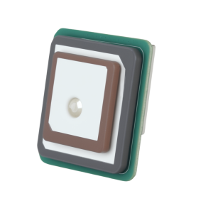
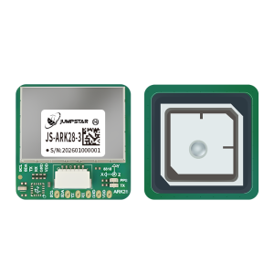
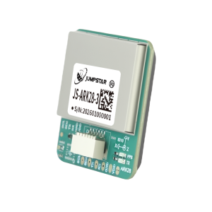
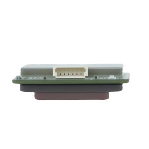
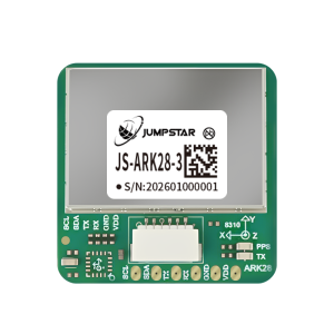
Type High Precision RTK GNSS Module Applicable Industry · UAV/Drones: Aerial surveying, autonomous flight and precise positioning
· Automotive Navigation and Tracking: Vehicle positioning, navigation and fleet management
· Smart Robots: Autonomous navigation and precise movement control
· Wearable Devices: Personal positioning and safety monitoring
· Intelligent Logistics Dispatch: Asset tracking and efficient dispatch management
· Personal & Workforce Safety IoT: Real-time location monitoring for personnel safety
· AVL and Location-Based Services: Automatic vehicle location and location-based applications
· Smart Handhelds: High-precision positioning for mobile data collection Params Receiver Type Dual-band (L1+L5) multi-constellation high-precision GNSS receiver
Constellations & Frequency Bands GPS L1/L5; BDS B1I/B1C/B2I/B2B/B2A; Galileo E1/E5; GLONASS G1; QZSS L1/L5; IRNSS L5; SBAS
Tracking Channels 200
Sensitivity Tracking & Navigation: -165dBm; Reacquisition: -159dBm; Hot Start: -159dBm; Cold Start: -148dBm
Time to First Fix (TTFF) Cold Start: 28s; AGPS: 1.5s; Hot Start: 1s (all satellites at ≥-130dBm)
Positioning Accuracy (CEP) Single Point: Horizontal 1.0m, Vertical 2.0m; RTK: Horizontal 1.0cm+1ppm, Vertical 1.5cm+1ppm (open sky, 50% CEP, 24h static, ≥-130dBm, >6SVs)
Time Accuracy PPS: <20ns RMS
Velocity Accuracy 0.1m/s CEP (50%@30m/s dynamic operation)
Operating Limits Dynamics: ≤4g; Altitude: 20000m; Velocity: 500m/s (airborne platform ≤4g)
Baud Rate 115200-2M bps (default: 115200bps; 2M bps for debug log)
Max Data Update Rate 20Hz (default: 1Hz; 20Hz requires specific firmware support)
Supported Protocols NMEA 0183 (Input/Output, ASCII); RTCM3.X (Input/Output)
Power Supply Voltage 3.3V-5.5V (Typical: 5.0V)
Operating Current 32mA-42mA @3.3V (Typical: 37mA @3.3V)
Backup Battery Voltage: 1.8V-3.6V (Typical: 3.3V); Current: 14uA @3.3V
Operating/Storage Temperature Operating: -40℃ to 85℃ (without Farah capacitor); Storage: -40℃ to 85℃
Farah Capacitance Temperature -25℃ to 60℃ (hot start unavailable outside this range)
Humidity 95%
Mechanical Dimensions 28.0×28.0×8.0mm ±0.3mm
Weight <12.0g
Antenna Type Passive antenna (25.0×25.0×2.0mm L5 stacked on 18.0×18.0×2.0mm L1)
Magnetometer Options Default: IST8310 (0x0F); Optional: QMC5883L (0x0D), VCM5883 (0x0C)
Compliance RoHS compliant Scope |
|||||||||
| JS-ANK45-2 | High Precision RTK GNSS Module | Plastic + Metal+ Ceramic | · UAVs & Drones: Autonomous flight, aerial surveying and mapping · Precision Agriculture: Auto-steering agricultural machinery, crop management · Automotive Applications: Intelligent driving, vehicle positioning · Shared Vehicles: High-precision location monitoring · Logistics & Security: Asset tracking, security monitoring · Surveying & Mapping: Geographic survey, topographic mapping · Smart Robots: Autonomous navigation, precise movement · Smart Ports: Automated terminal operation, container positioning · Power Grid & Electricity: Power facility inspection, grid positioning · Intelligent Transportation: Traffic monitoring, vehicle management | ||||||
|
Images
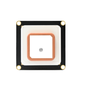
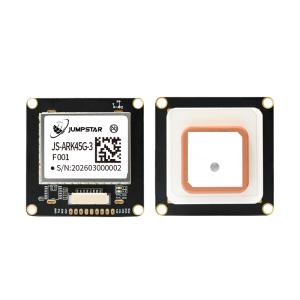
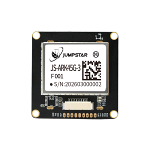
Type High Precision RTK GNSS Module Applicable Industry · UAVs & Drones: Autonomous flight, aerial surveying and mapping
· Precision Agriculture: Auto-steering agricultural machinery, crop management
· Automotive Applications: Intelligent driving, vehicle positioning
· Shared Vehicles: High-precision location monitoring
· Logistics & Security: Asset tracking, security monitoring
· Surveying & Mapping: Geographic survey, topographic mapping
· Smart Robots: Autonomous navigation, precise movement
· Smart Ports: Automated terminal operation, container positioning
· Power Grid & Electricity: Power facility inspection, grid positioning
· Intelligent Transportation: Traffic monitoring, vehicle management Params Receiver type Multi-system, multi-frequency high-precision RTK GNSS receiver
Constellations & Bands BDS B1I/B2I/B3I, GPS L1/L2/L5, GLONASS L1/L2, Galileo E1/E5a/E5b, QZSS L1/L2/L5, SBAS
Channels 1408 super channels
Time to First Fix (Cold start) <30s
Positioning Accuracy (RMS) 3D: 1.5m; DGPS: 0.4m+1ppm; RTK Horizontal: 1.5cm+1ppm; RTK Vertical: 2.0cm+1ppm
Time Accuracy (RMS) 20ns
Velocity Accuracy 0.03m/s
RTK Initialization Time <5s (typical)
Baud Rate 9600-921600bps (Default: 115200bps)
Max Data Update Rate 20Hz
Supported Protocols NMEA 0183, Unicore, RTCM3.X
Power Supply Voltage 3.0V-5.5V (Typical: 5.0V)
Operating Current 180mA-310mA @3.3V
Operating Temperature -40℃ to 85℃
Storage Temperature -40℃ to 85℃
Mechanical Dimensions 45.0×45.0×12.7mm ±0.3mm
Weight <40g
Antenna Type Passive high-gain integrated antenna
Magnetometer Options IST8310 (Default), QMC5883L, VCM5883
Compliance RoHS Scope |
|||||||||
| JS-A56U9D | High Precision RTK GNSS Module for UAV | Plastic + Metal | · UAVs & Drones: Mapping, surveying, and autonomous flight. · Precision Agriculture: Auto-steering tractors and crop spraying drones. · Autonomous Systems: AMRs, robotic lawn mowers, and intelligent logistics. · Geographic Information Systems (GIS): High-accuracy mobile data collection. | ||||||
|
Images
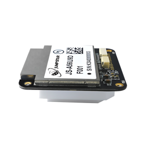
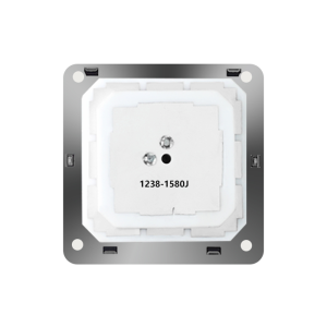
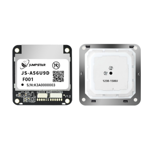
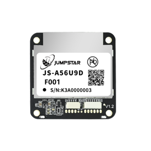
Type High Precision RTK GNSS Module for UAV Applicable Industry · UAVs & Drones: Mapping, surveying, and autonomous flight.
· Precision Agriculture: Auto-steering tractors and crop spraying drones.
· Autonomous Systems: AMRs, robotic lawn mowers, and intelligent logistics.
· Geographic Information Systems (GIS): High-accuracy mobile data collection. Params Receiver type Multi-band GNSS high precision receiver
Constellations GPS, BDS, GLONASS, Galileo, QZSS, SBAS
Channels 192 search channels / 60 tracking channels
Accuracy of time pulse signal RMS 30ns
99% 60ns
Frequency of time pulse signal 0.25 Hz to 10 MHz(configurable)
Operational limits Dynamics ≤4g
Altitude 80,000m
Velocity 500 m/s
Velocity accuracy 0.05m/s
Dynamic heading accuracy 0.3⁰
NMEA 0183 V4.11/ V4.0/V4.1 Input/output, ASCII
RTCM 3.3 Input/output, binary
UBX Input/output, binary, u-blox proprietary Scope |
|||||||||
| JS-TP26-U | GNSS Module with IMU | Plastic + Metal | · Automotive Navigation & Vehicle-Mounted Positioning · Intelligent Driving & Vehicle Control · Maritime Navigation & Fleet Management · Intelligent Logistics Dispatching & Asset Tracking · Traffic Monitoring & Urban Traffic Management · Underground Parking & Tunnel Positioning · Intelligent Transportation & Vehicle Networking · High-Precision Mobile Positioning Terminals | ||||||
|
Images
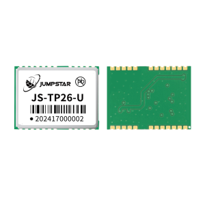
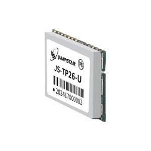
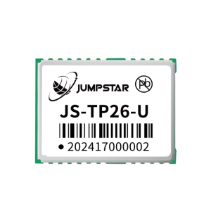
Type GNSS Module with IMU Applicable Industry · Automotive Navigation & Vehicle-Mounted Positioning
· Intelligent Driving & Vehicle Control
· Maritime Navigation & Fleet Management
· Intelligent Logistics Dispatching & Asset Tracking
· Traffic Monitoring & Urban Traffic Management
· Underground Parking & Tunnel Positioning
· Intelligent Transportation & Vehicle Networking
· High-Precision Mobile Positioning Terminals Params Receiver Type Dual-band (L1+L5) GNSS+INS integrated navigation module
Supported Constellations & Bands GPS:L1CA/L5; BDS:L1/L5; GLONASS:L1OF; Galileo:E1B/E1C/E5a; QZSS:L1CA/L1SAIF/L5; SBAS:WAAS/EGNOS/MSAS/GAGAN
Tracking Channels 135 channels (L1:75, L5:60)
Sensitivity Tracking & Navigation:-165dBm; Acquisition:-148dBm
Positioning Accuracy Single-point:Horizontal 1.0m(L1+L5)/2.5m(L1) CEP; GNSS+INS:<1.5m CEP
Time Accuracy 1PPS:±10ns
Inertial Navigation Six-axis MEMS(3-axis gyro+3-axis accelerometer); Adaptive installation
Operational Limits Altitude≤10000m; Velocity≤100m/s
Max Update Rate 10Hz
Baud Rate 115200~921600bps (Default:115200bps)
Supported Protocols NMEA 0183 V4.1; RTCM v2.3/v3.3
Interfaces 3×UART, USB, 1PPS, EXTINT, RF_IN, RESET_N, Power
Power Supply VCC:3.03.6V(Typical:3.3V); Backup:1.653.6V; VCC_RF:3.3V
Operating Current Acquisition:3549mA@3.3V; Tracking:3144mA@3.3V; Backup:10uA@3.3V
ESD Performance 2000V (HBM)
Operating Temperature -40℃ ~ +85℃
Humidity 95%
Mechanical Dimensions 16.0mm × 12.2mm × 2.4mm ±0.3mm
Compliance RoHS compliant Scope |
|||||||||
| JS-RP26-U | GNSS Module with IMU | Plastic + Metal | · Rail Transit Intelligent Positioning · Automotive Navigation & Vehicle Tracking · Maritime Navigation & Fleet Management · UAV & Drone High-Dynamic Navigation · Emergency Rescue & Personal Protection · Intelligent Logistics Dispatching & Asset Tracking · AVL & Location-Based Services(LBS) · Portable Positioning & Tracking Devices | ||||||
|
Images
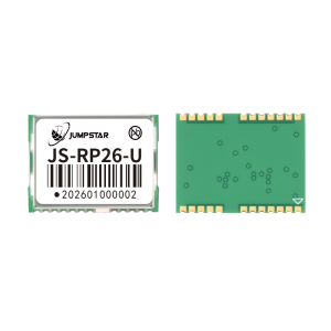
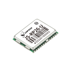
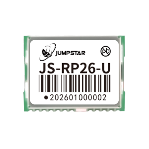
Type GNSS Module with IMU Applicable Industry · Rail Transit Intelligent Positioning
· Automotive Navigation & Vehicle Tracking
· Maritime Navigation & Fleet Management
· UAV & Drone High-Dynamic Navigation
· Emergency Rescue & Personal Protection
· Intelligent Logistics Dispatching & Asset Tracking
· AVL & Location-Based Services(LBS)
· Portable Positioning & Tracking Devices Params Receiver Type Single-frequency (L1) GNSS+INS integrated navigation module
Supported Constellations & Bands GPS:L1; BDS:B1I/B1C; GLONASS:G1; Galileo:E1; QZSS:L1
Tracking Channels 200 tracking channels + dedicated search engine
Sensitivity Tracking:-165dBm; Reacquisition:-159dBm; Cold Start:-148dBm
Time to First Fix Cold Start:28s; Warm Start:1s
Positioning Accuracy Single-point:Horizontal 1.0m CEP; Vertical 2.0m CEP
Speed Accuracy 0.1m/s CEP (50%@30m/s dynamic operation)
Inertial Navigation GNSS signal loss within 120s: positioning error ≤5%
Operational Limits Dynamics≤4g; Altitude≤20000m; Velocity≤500m/s
Max Update Rate 20Hz (Default:1Hz)
Baud Rate 115200~921600bps (Default:115200bps)
Supported Protocols NMEA 0183(ASCII); RTCM3.X(differential positioning)
Antenna Function Active antenna detection + overcurrent protection; Antenna gain ≤30dB
Power Supply VCC:2.03.6V (Typical:3.3V); Backup:1.83.6V
Operating Current Average:16~30mA@3.3V; Standby:14uA@3.3V
Digital I/O Voltage 1.8~3.6V
Operating Temperature -40℃ ~ +85℃
Humidity 95%
Mechanical 16.2mm × 12.2mm × 2.3mm ±0.3mm; Weight<1.1g
Main Interfaces UART(TX/RX), 1PPS, RF_IN, VCC_RF, RESET_N, I2C(internal IMU)
Compliance RoHS compliant Scope |
|||||||||
| JS-RK26-U | RTK GNSS Module with IMU | Plastic + Metal | · Rail Transit Intelligent Positioning · Automotive Navigation & Vehicle Tracking · Maritime Navigation & Fleet Management · UAV & Drone High-Dynamic Navigation · Emergency Rescue & Personal Protection · Intelligent Logistics Dispatching & Asset Tracking · AVL & Location-Based Services(LBS) · High-Precision Portable Positioning Devices | ||||||
|
Images
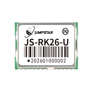
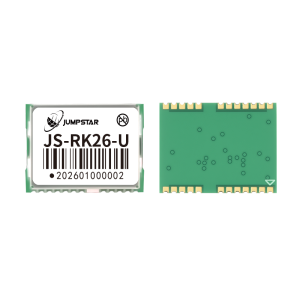
Type RTK GNSS Module with IMU Applicable Industry · Rail Transit Intelligent Positioning
· Automotive Navigation & Vehicle Tracking
· Maritime Navigation & Fleet Management
· UAV & Drone High-Dynamic Navigation
· Emergency Rescue & Personal Protection
· Intelligent Logistics Dispatching & Asset Tracking
· AVL & Location-Based Services(LBS)
· High-Precision Portable Positioning Devices Params Receiver Type Dual-band (L1+L5) GNSS+INS integrated navigation module
Supported Constellations & Bands GPS:L1/L5; BDS:B1I/B1C/B2I/B2B/B2A; GLONASS:G1; Galileo:E1/E5; QZSS:L1/L5; IRNSS:L5
Tracking Channels 200 tracking channels + dedicated search engine
Sensitivity Tracking:-165dBm; Reacquisition:-159dBm; Hot Start:-159dBm; Cold Start:-148dBm
Time to First Fix Cold Start:28s; AGPS:1.5s; Warm Start:1s
Positioning Accuracy Single-point:Horizontal 1.0m/Vertical 2.0m; RTK:Horizontal 1.0cm+1ppm/Vertical 1.5cm+1ppm
Speed Accuracy 0.1m/s CEP
Inertial Navigation GNSS loss within 120s: error ≤5%
Operational Limits Dynamics≤4g; Altitude≤20000m; Velocity≤500m/s
Max Update Rate 10Hz (Default:1Hz)
Baud Rate 9600~921600bps (Default:115200bps)
Supported Protocols NMEA 0183; RTCM3.X; Private binary protocol
Antenna Function Active antenna detection + overcurrent protection; Antenna gain ≤30dB
Power Supply VCC:2.03.6V; Backup:1.83.6V
Operating Current Average:18~32mA@3.3V; Standby:14uA@3.3V
Digital I/O 1.8~3.6V
Operating Temperature -40℃ ~ +85℃
Humidity 95%
Mechanical 16.2×12.2×2.3mm±0.3mm; Weight<1.1g
Main Interfaces UART(TX/RX), 1PPS, RF_IN, VCC_RF, RESET_N, I2C(internal IMU)
Compliance RoHS compliant Scope |
|||||||||
| S-C8A | RTK GNSS Module with IMU | Plastic + Metal | · Intelligent Driving & Automotive Electronics · Drones & UAV High-Precision Navigation · Intelligent Robots & Autonomous Equipment · Maritime Navigation & Fleet Management · Personal Protection & Emergency Rescue · Car Navigation & Tracking · High-Precision Positioning Terminals | ||||||
|
Images
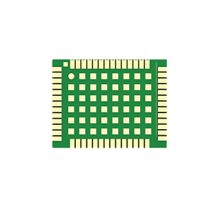
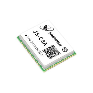
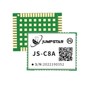
Type RTK GNSS Module with IMU Applicable Industry · Intelligent Driving & Automotive Electronics
· Drones & UAV High-Precision Navigation
· Intelligent Robots & Autonomous Equipment
· Maritime Navigation & Fleet Management
· Personal Protection & Emergency Rescue
· Car Navigation & Tracking
· High-Precision Positioning Terminals Params Supported Constellations & Bands GPS:L1C/A,L2P,L2C; BDS-2:B1I,B2I; BDS-3:B1C,B2b; GLONASS:G1,G2; Galileo:E1,E5b; QZSS:L1C/A,L2C; SBAS:L1C/A
Sensitivity Tracking & Navigation:-155dBm; Acquisition:-138dBm
Time to First Fix Cold Start:<20s; Warm Start:<10s; RTK Initialization:<5s; Lost Lock Reacquisition:<1s
Positioning Accuracy Single-point:H≤1.5m,V≤3m(1σ,PDOP≤4); RTK:H±(8+10⁻⁶×D)mm,V±(15+10⁻⁶×D)mm
Measurement Accuracy Pseudorange:≤10cm; Carrier phase:≤1mm
Speed & Timing Accuracy Speed:≤0.02m/s; Timing:20ns
Inertial Navigation Parameters Gyro:Range 250°/s,Zero deviation 0.5°/s; Acceleration:Range 4g,Zero deviation 20mg; 3s loss lock:cm-level; 10s loss lock:m-level
Data Rate Measurement&Positioning:100Hz(optional); RTK Positioning:20Hz(optional)
Supported Protocols NMEA 0183; Custom CNB binary; CMR; RTCM2.X; RTCM3.X(MSM3~MSM7)
Antenna 50Ω impedance; Power:3.35V; Gain:2035dB
Power Supply VCC:3.3V±5% DC; VCC_RF:3.35.5V; V_BCKP:1.83.6V
Power Consumption 0.8W@3.3V(anti-interference off); 0.9W@3.3V(anti-interference on)
Operating Temperature -40℃ ~ +85℃
Storage Temperature -55℃ ~ +95℃
Humidity 95%
Mechanical Dimensions 22.0mm × 17.0mm × 2.8mm ±0.3mm
Main Interfaces 3×UART, I2C, SPI, PPS, RST, EVENT, Antenna Detection, Power
Compliance RoHS compliant Scope |
|||||||||
| JS-YAC155N | High precision survey antenna | Plastic + Metal | •Geodetic Mapping & Aerial Surveying •Road & Railway Construction •Marine & Channel Surveying •Landslide & Earthquake Monitoring •Port Container Operations •Drainage Measurement •Urban Underground Utility Tunnel Monitoring •Power Grid Inspection •UAV Surveying Operations •Smart Precision Agriculture •Driving Test & Training •Intelligent Logistics Warehousing | ||||||
|
Images
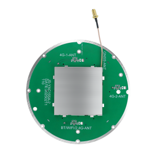
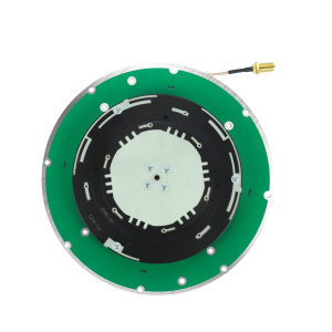
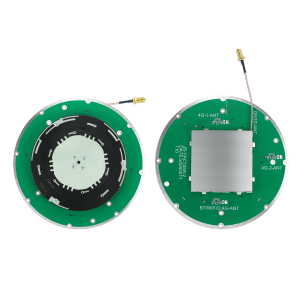
Type High precision survey antenna Applicable Industry •Geodetic Mapping & Aerial Surveying
•Road & Railway Construction
•Marine & Channel Surveying
•Landslide & Earthquake Monitoring
•Port Container Operations
•Drainage Measurement
•Urban Underground Utility Tunnel Monitoring
•Power Grid Inspection
•UAV Surveying Operations
•Smart Precision Agriculture
•Driving Test & Training
•Intelligent Logistics Warehousing Params Antenna Type Integrated Communication & Navigation High-Precision Built-in Survey Antenna
Supported Signals GNSS: BDS B1I/B2I, GPS L1/L2, GLONASS L1/L2, Galileo E1/E5a/E5b, QZSS L1/L2 (1165-1268MHz; 1550-1630MHz) 4G: Full bands supported; BT: 2.4G
Peak Gain GNSS ≥5.5dB; 4G ≥0.5dB; BT ≥0.5dB
Impedance 50Ω
Horizontal Coverage 360°
Output VSWR (Passive) ≤2.0
Amplifier Gain 35±2dB
Noise Figure ≤2.0dB (per-filter)
Output VSWR (LNA) ≤2.5
In-Band Flatness ±2dB
Operating Voltage 3.3~12V DC
Operating Current ≤50mA (@5V)
Dimensions Ø155×16.3mm (Tolerance ±0.5mm)
RF Connectors GNSS: MCX-C-JW1.5 (RG178 cable) 4G: MMCX-C-JW1.5 (RG178 cable)
Materials Antenna: PPO; PCB: FR4; Shielding Cover: Tinplate
Operating Temperature -40℃ ~ +85℃
Storage Temperature -40℃ ~ +85℃
Vibration Sine sweep 1g(0-p), 105510Hz per axis Scope |
|||||||||
| JS-YAC130N | high precision survey antenna | Plastic + Metal | •Geodetic Surveying •Marine & Channel Surveying •Dredging Surveying •Road Construction & Engineering •Landslide & Seismic Monitoring •Port Container Operations •Smart Precision Agriculture •Driving Tests & Training | ||||||
|
Images
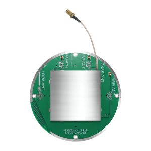
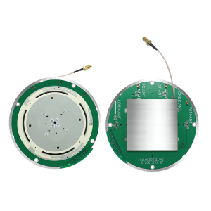
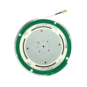
Type high precision survey antenna Applicable Industry •Geodetic Surveying
•Marine & Channel Surveying
•Dredging Surveying
•Road Construction & Engineering
•Landslide & Seismic Monitoring
•Port Container Operations
•Smart Precision Agriculture
•Driving Tests & Training Params Antenna Type Integrated Communication & Navigation High-Precision Survey Antenna
Supported Signals GNSS: BDS B1I/B2I, GPS L1/L2, GLONASS L1/L2, Galileo E1/E5a/E5b, QZSS L1/L2 (1165-1268MHz; 1550-1630MHz) 4G: 824960MHz, 17102690MHz BT: 2.4G
Peak Gain GNSS ≥5.5dB; 4G ≥0.5dB; BT ≥0.5dB
Impedance 50Ω
Horizontal Coverage 360°
Output VSWR ≤2.0
LNA Gain 35±2dB
Noise Figure ≤3.0dB (per-filter)
In-Band Flatness ±2dB
Operating Voltage 3.3~12V DC
Operating Current ≤50mA (@5V)
Dimensions Ø130×15mm
RF Connectors GNSS: MCX-C-JW1.5 (RG178 cable) 4G: MMCX-C-JW1.5 (RG178 cable)
Materials Radome: PPO; PCB: FR4; Shielding-Can: Tinplate
Operating Temperature -40℃ ~ +85℃
Storage Temperature -40℃ ~ +85℃
Vibration Sine sweep 1g(0-p), 105510Hz per axis Scope |
|||||||||
| JS-PAS51A-D5 | Vehicle-mounted antenna | Plastic + Metal | •Vehicle Navigation & Positioning •Fleet Management & Tracking •Automotive Telematics Devices •Portable Mobile Positioning Terminals •IoT Vehicle-Mounted Sensors •Commercial Vehicle Monitoring •Outdoor Mobile Positioning Equipment •Industrial Vehicle & Machinery Positioning | ||||||
|
Images
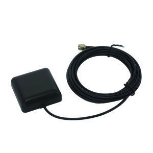
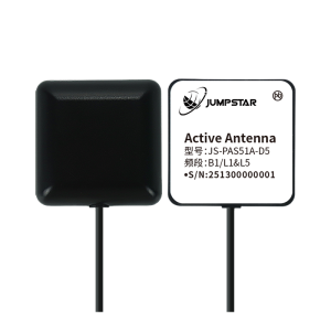
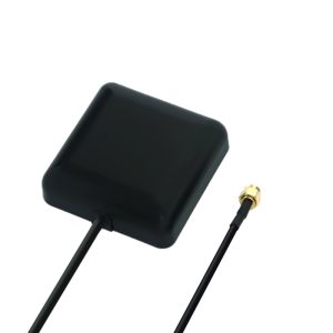
Type Vehicle-mounted antenna Applicable Industry •Vehicle Navigation & Positioning
•Fleet Management & Tracking
•Automotive Telematics Devices
•Portable Mobile Positioning Terminals
•IoT Vehicle-Mounted Sensors
•Commercial Vehicle Monitoring
•Outdoor Mobile Positioning Equipment
•Industrial Vehicle & Machinery Positioning Params Antenna Type Vehicle-Mounted External Active GNSS Antenna
Ceramic Antenna B1&L1: 36×36×2mm; L5:25×25×4mm (Dielectric Ceramic)
Operating Frequency B1:1561.098±2.046MHz; L1:1575.42±1.023MHz; L5:1176.45±10.23MHz
Impedance 50Ω
Polarization RHCP (Right-Hand Circular Polarization)
VSWR ≤2.0
Max Gain 2.5dBic(B1I&B1C); 0dBic(B2a) (39×39 test baseboard)
LNA Gain 28±3dB
Noise Figure ≤2.0dB
Operating Voltage 3~5V DC
Operating Current 15±3mA @3.3V
Connector SMA-J3
RF Cable RG174 (Length: 3000±100mm)
Dimensions 51.4±0.5mm (main body)
Mounting NdFeB Magnetic Mount
Protection Rating IPX7
Materials Antenna: Dielectric Ceramic; PCB: FR4; Shielding: Tinplate
Operating Temperature -40℃ ~ +85℃
Storage Temperature -40℃ ~ +85℃
Vibration Sine sweep 1g(0-p), 105510Hz per axis Scope |
|||||||||
| JS-HAS67A-D2 | Vehicle & Fleet Antennas | Plastic + Metal | •Portable Handheld Positioning Terminals •IoT Smart Positioning Nodes •Miniature UAV Navigation Systems •Vehicle-Mounted Positioning Equipment •Battery-Powered Mobile Devices •Industrial Control & Embedded Positioning Modules •Outdoor & Harsh Environment Positioning Scenarios | ||||||
|
Images
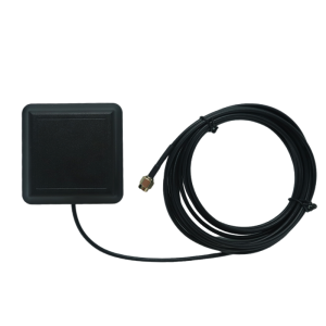
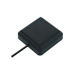
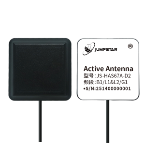
Type Vehicle & Fleet Antennas Applicable Industry •Portable Handheld Positioning Terminals
•IoT Smart Positioning Nodes
•Miniature UAV Navigation Systems
•Vehicle-Mounted Positioning Equipment
•Battery-Powered Mobile Devices
•Industrial Control & Embedded Positioning Modules
•Outdoor & Harsh Environment Positioning Scenarios Params Antenna Type B1/L1&L2/G1 Dual-Band Ceramic Active GNSS Antenna
Ceramic Patch L1:25×25×4mm; L2:33×33×4mm (Dielectric Ceramic)
Operating Frequency B1:1561.098±2.046MHz; L1:1575.42±1.023MHz; L2:1227.60±10.23MHz; G1:1602.5625±4MHz
Impedance 50Ω
Polarization RHCP (Right-Hand Circular Polarization)
VSWR ≤2.0
Max Gain 3dBic(B1/L1/G1); 2.5dBic(L2) (55×55 test base plate)
LNA Gain 28±3dB
Noise Figure ≤2.0dB
Operating Voltage 3~5V DC
Operating Current 20±3mA @3.3V
Connector SMA-J3
RF Cable RG174 (L=3000±100mm)
Dimensions 67±0.5mm × 67±0.5mm × 21.5±0.5mm
Mounting Neodymium Iron Boron Magnetic Mount
Protection Rating IPX7
Materials Antenna:Dielectric Ceramic; PCB:FR4; Shielding:Tinplate
Operating Temperature -40℃ ~ +80℃
Storage Temperature -40℃ ~ +85℃
Vibration Sine sweep 1g(0-p), 105510Hz per axis Scope |
|||||||||
| JS-HAS37 | Vehicle & Fleet Antennas | Plastic + Metal | •Miniature GNSS Positioning Terminals •Portable Handheld Positioning Devices •IoT Smart Sensors & Nodes •Consumer Electronics with Positioning •Battery-Powered Low-Power Equipment •Compact UAV/Robot Positioning Modules •Industrial Control & Embedded Systems | ||||||
|
Images
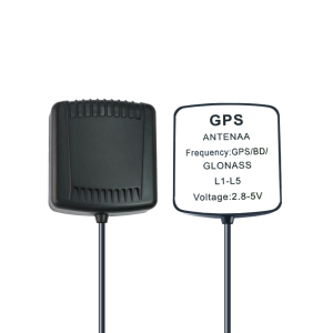
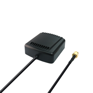
Type Vehicle & Fleet Antennas Applicable Industry •Miniature GNSS Positioning Terminals
•Portable Handheld Positioning Devices
•IoT Smart Sensors & Nodes
•Consumer Electronics with Positioning
•Battery-Powered Low-Power Equipment
•Compact UAV/Robot Positioning Modules
•Industrial Control & Embedded Systems Params Antenna Type L1/L5 Dual-Band Active GNSS Antenna
Antenna Patch L1:25×25×4mm; L5:36×36×4mm (Dielectric Ceramic)
Frequency Range L1:1559MHz1615MHz; L5:1176MHz1200MHz
Supported Signals GPS L1C/A/L5; BDS B1I/B1C/B2a; GLONASS L1CA; Galileo E1/E5a
Impedance 50Ω
Polarization RHCP (Right-Hand Circular Polarization)
VSWR ≤2.0
Gain 4.0dBic(L1), 3.0dBic(L5) at Zenith Max
Axial Ratio ≤5dB at Zenith
LNA Gain 28±3dB
Out-of-band Rejection ≥25dB(FH+100MHz/FL-100MHz)
Noise Figure ≤2.0dB
Operating Voltage 3~5V DC
Operating Current 8±3mA (at 3.3V)
Connector SMA-J3
Materials Antenna:Dielectric Ceramic; PCB:FR4; Shielding:Tinplate
Operating Temperature -40℃ ~ +85℃
Storage Temperature -40℃ ~ +105℃
Vibration Sine sweep 1g(0-p), 105510Hz per axis Scope |
|||||||||
| JS-HAC148A | High Precision Vehicle & Fleet Antennas | Plastic + Metal | •Marine / Channel / Dredging Survey •Bridge Deformation Monitoring •Landslide / Seismic Monitoring •Port Container Operations •Smart Precision Agriculture •Driver's License Testing & Training •Vehicle Positioning & Fleet Management | ||||||
|
Images
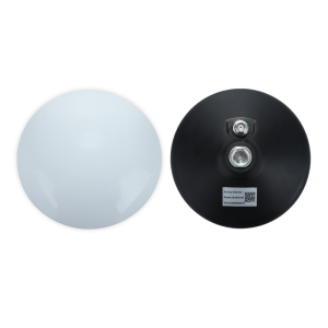
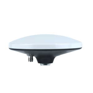
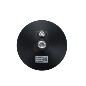
Type High Precision Vehicle & Fleet Antennas Applicable Industry •Marine / Channel / Dredging Survey
•Bridge Deformation Monitoring
•Landslide / Seismic Monitoring
•Port Container Operations
•Smart Precision Agriculture
•Driver's License Testing & Training
•Vehicle Positioning & Fleet Management Params Parameter Specification
Antenna Type Quad-System Full-Frequency RTK Surveying Antenna
Frequency Range 1164–1278MHz; 1559–1606MHz (BDS/GPS/GLONASS/Galileo/QZSS all bands supported)
Phase Center Error ≤2mm
Gain 4.5dBic (max)
Axial Ratio ≤3dB (at Zenith)
Impedance 50Ω
Azimuth Coverage 360° full horizontal coverage
VSWR ≤2.0
Polarization Right-Hand Circular Polarization (RHCP)
Amplifier Gain 38±3dB
Out-of-band Rejection ≥40dB (FH+100MHz; FL-100MHz)
Noise Figure ≤3.0dB (per-filter)
Operating Voltage 3.3~12.0V DC
Operating Current ≤30mA (16mA@5V)
Dimensions Ø148×57.7mm (excluding base)
Connector TNC-K
Mounting Strong Magnetic Base
Materials Antenna: PPO; Housing: ABS; Connector: TNC-K
Protection Rating IPX6
Operating Temperature -40℃ ~ +85℃
Storage Temperature -40℃ ~ +85℃
Vibration Sine sweep 1g(0-p), 105510Hz per axis Scope |
|||||||||
| JS-HAC100B | High Precision UAV Antennas | Plastic + Metal | •Professional Surveying & Mapping •Marine Navigation & Ocean Survey •Precision Agriculture •Geological Monitoring •Automotive Navigation & Tracking •Geographic Surveying •AVL & Location-Based Services •Unmanned Vehicles •Fleet Management •Outdoor & Marine High-Precision Positioning | ||||||
|
Images
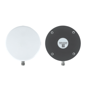
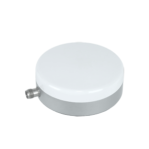
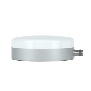
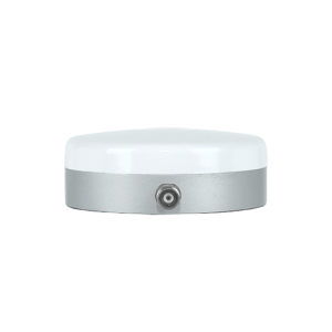
Type High Precision UAV Antennas Applicable Industry •Professional Surveying & Mapping
•Marine Navigation & Ocean Survey
•Precision Agriculture
•Geological Monitoring
•Automotive Navigation & Tracking
•Geographic Surveying
•AVL & Location-Based Services
•Unmanned Vehicles
•Fleet Management
•Outdoor & Marine High-Precision Positioning Params Antenna Type:Three-System Seven-Frequency High-Precision GNSS Measurement Antenna
Supported Signals: BDS: B1I/B1C/B2I/B2A/B3I; GPS: L1/L2; GLONASS: L1/L2
Frequency Bands: L1(15591615MHz), L2(12001250MHz), B3(1258~1278MHz)
Impedance: 50Ω
Polarization: Right-Hand Circular Polarization (RHCP)
Gain: 4.5dBi
Azimuth Coverage: 360°
Phase Center Error: ±2mm
LNA Gain: 40±2dB
Noise Figure: ≤2.0dB
VSWR: ≤2.0
Axial Ratio: ≤3.0dB
Operating Voltage: 3.0–15.0V DC
Operating Current: ≤45mA
Dimensions: Φ100mm × 36.5mm ±0.5mm
Connector: TNC-K
Mounting Magnetic Sucker
Waterproof Rating: IP67
Material Antenna: PTFE F4B-1/2; Housing: ABS
Operating Temperature: -40℃ ~ +70℃
Storage Temperature: -55℃ ~ +85℃
Humidity: 95% Non-condensing Scope |
|||||||||
| JS-X168 | High Precision Anti-jamming Antenna | Plastic + Metal | •Airborne Equipment (UAVs, Aircraft) •High-Security Anti-Jamming Positioning Scenarios | ||||||
|
Images
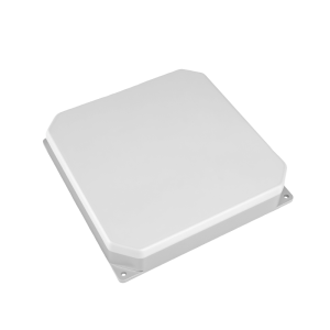
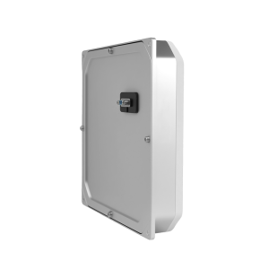
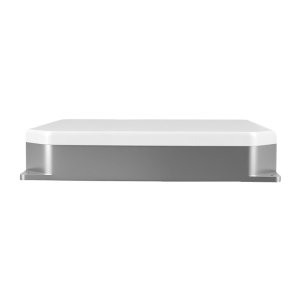
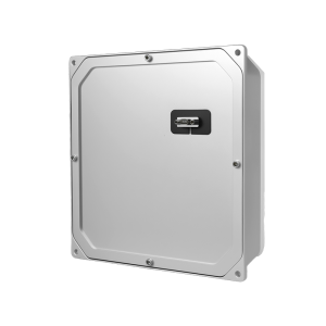
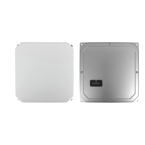
Type High Precision Anti-jamming Antenna Applicable Industry •Airborne Equipment (UAVs, Aircraft)
•High-Security Anti-Jamming Positioning Scenarios Params Product Type: Five-Array Anti-Jamming GNSS Receiver (Integrated Anti-Jamming Antenna)
Receive Frequency Bands: GPS: L1/L2/L5; BDS: B1/B2/B3; GLONASS: G1/G2; Galileo: E1/E5/E6
Anti-Jamming Bands: Consistent with receive frequency bands
Anti-Jamming Capability: 115dB (Single interference); 95dB (Three interferences)
Anti-Jamming Components: Five-component anti-jamming device
Operating Voltage: 5V DC
Rated Power Consumption: ≤2W (Indoor temperature)
RF Front-End Low noise figure, high receiving sensitivity
Output Interface: J30J-9TP (Matching plug: J30J-9ZKL)
Protocol Output: TX1: NMEA; TX2: SBF
Dimensions: 168×168×32mm (Excluding connector)
Weight: ≤555g
Operating Temperature: -40℃ ~ +70℃
Pin Definition: 1: VIN+ (5V Input); 2: GND; 3: TX2_SBF Output; 4: TX1_NMEA Output Scope |
|||||||||
| JS-HAC42A-F | High Precision Helical Antenna for UAV | Plastic + Metal | •High-precision surveying and mapping •Navigation and scheduling systems •Light UAV aerial survey & remote telemetry | ||||||
|
Images
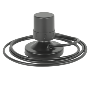
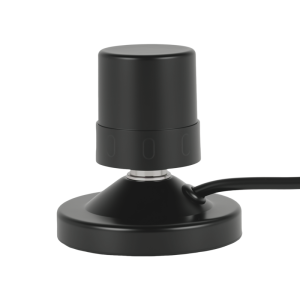
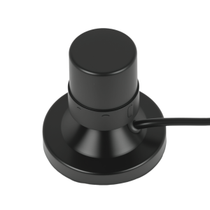
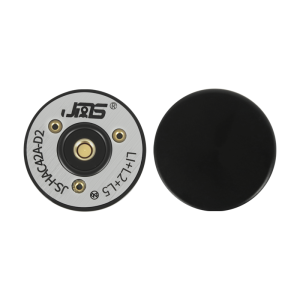
Type High Precision Helical Antenna for UAV Applicable Industry •High-precision surveying and mapping
•Navigation and scheduling systems
•Light UAV aerial survey & remote telemetry Params Antenna Type: Helical GNSS Active Antenna
Supported Signals: GPS(L1/L2/L5); BDS(B1I/B1C/B2(I/Q)/B2b/B2a); GLONASS(G1); GALILEO(E1/E5/E5a/E5b)
Impedance: 50Ω
Polarization: Right Hand Circular Polarization (RHCP)
Horizontal Coverage:360°
VSWR: ≤2.0
Noise Figure: ≤2dB
LNA Gain :37±3dB
Dimensions: Φ44.8mm × 42mm
Weight: 27.3g
Connector: SMA Male
Mounting Screw fixing (reserved)
Waterproof Rating: IP65 (with mated SMA connector)
Operating Temperature: -30℃ ~ +70℃
Storage Temperature: -35℃ ~ +75℃
Humidity: 0%~95% Non-condensing Scope |
|||||||||
| JS-HAC27A-D2 | High Precision Helical Antenna for UAV | Plastic + Metal | •High-precision surveying and mapping •Navigation and scheduling systems •Light UAV aerial survey & remote telemetry | ||||||
|
Images
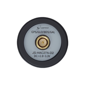
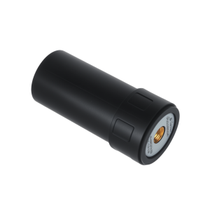
Type High Precision Helical Antenna for UAV Applicable Industry •High-precision surveying and mapping
•Navigation and scheduling systems
•Light UAV aerial survey & remote telemetry Params Antenna Type: Helical GNSS Active Antenna
Supported Satellite Systems: BDS, GPS, GLONASS, Galileo
Impedance: 50Ω
Polarization: Right-Hand Circular Polarization (RHCP)
Axial Ratio: ≤3dB
Horizontal Coverage: 360°
VSWR: ≤2.0
LNA Gain: 28±3dB
Noise Figure: ≤2.0dB
Operating Voltage: +2.8~3.3V DC
Dimensions: Φ28.2mm × H59.3mm
Weight: 16.7g
Connector: SMA Male Straight
Mounting SMA : Threaded Knob
Waterproof Rating: IP65 (with mated SMA connector)
Operating Temperature: -30℃ ~ +70℃
Storage Temperature: -35℃ ~ +75℃
Humidity: 0%~95% Non-condensing Scope |
|||||||||
| JS-HAC18A-F | High Precision Helical Antenna for UAV | Plastic + Metal | •Light-duty UAV aerial survey/mapping/remote telemetry •UAV security inspection | ||||||
|
Images
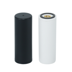
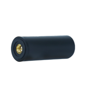
Type High Precision Helical Antenna for UAV Applicable Industry •Light-duty UAV aerial survey/mapping/remote telemetry
•UAV security inspection Params Antenna Type: Helical GNSS Active Antenna
Received Signals: GPS(L1/L2/L5), BDS(B1/B2), GLONASS(G1/G3), Galileo(E1/E5a/E5b), QZSS(L1/L2/L5), SBAS(L1/L5), IRNSS(L5)
Impedance: 50Ω
Polarization: Right-Hand Circular Polarization (RHCP)
Axial Ratio: ≤3dB
Horizontal Coverage: 360°
VSWR: ≤2.0
LNA Gain: 33±2dB
Noise Figure: ≤2dB
Operating Voltage: +2.8~3.3V DC
Operating Current: ≤30mA
Dimensions: Φ18mm × H50.8mm
Weight: 10.8g
Connector: SMA Male Straight
Waterproof Rating: IP65 (with mated SMA connector) Scope |
|||||||||
| JS-UK43 | High Precision Smart Antenna | Plastic + Metal | Handheld High-Precision Positioning Terminals · UAV & Drone Navigation & Control · Agricultural Automation & Precision Farming · Intelligent Robots & Unmanned Equipment · Vehicle Management & Fleet Monitoring · Assisted Driving & Automotive Electronics · Smart City & Intelligent Traffic · Intelligent Safety Testing & Industrial Detection | ||||||
|
Images
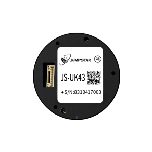

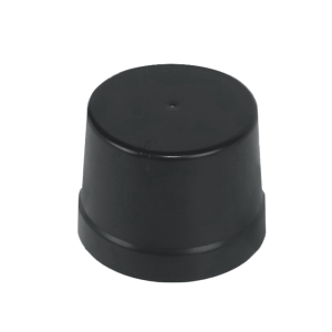
Type High Precision Smart Antenna Applicable Industry Handheld High-Precision Positioning Terminals
· UAV & Drone Navigation & Control
· Agricultural Automation & Precision Farming
· Intelligent Robots & Unmanned Equipment
· Vehicle Management & Fleet Monitoring
· Assisted Driving & Automotive Electronics
· Smart City & Intelligent Traffic
· Intelligent Safety Testing & Industrial Detection Params Receiver Type: Multi-band multi-mode GNSS RTK positioning module
Supported Constellations & Signals: GPS/QZSS/SBAS:L1C/A,L2C; GLONASS:L1OF,L2OF; BDS:B1I,B2I; Galileo:E1,E5b
Channel Configuration: 192 search channels; 60 tracking channels
Sensitivity: Tracking:-167dBm; Reacquisition:-148dBm
Time to First Fix: Cold Start:25s; Warm Start:20s; Hot Start:2s
Positioning Accuracy: PVT:1.5m CEP; SBAS:1.0m CEP; RTK:2cm+1ppm(Horizontal)
Time & Speed Accuracy: 1PPS(RMS):30ns; Velocity:0.05m/s
Operational Limits: Dynamics≤4g; Altitude≤80000m; Velocity≤500m/s
Baud Rate: 9600~921600bps (Default:38400bps)
Max Update Rate: RTK(GPS):20Hz; Full GNSS:7Hz
Supported Protocols: NMEA 4.11/4.10/4.0/2.3/2.1; RTCM 3.3; UBX (proprietary)
Antenna: Passive antenna; Default:φ35mm×25mm
Interfaces: 8-pin:GND, TX2, RX2/PPS, SDA, SCL, TX1, RX1, VCC; 2×UART, I2C
Power Supply: 3.3~5.5V (Typical:5.0V)
Operating Current: Acquisition: 110140mA@5V; Tracking:110130mA@5V Scope |
|||||||||
| JS-SK43H-AH | High Precision Smart Antennas | Plastic + Metal | · UAV & Drone High-Precision Navigation & Heading · Autonomous Robots & Unmanned Systems · Precision Agriculture & Farm Machinery Navigation · Surveying & Mapping & Geodetic Measurement · Maritime Navigation & Vessel Heading · Smart Port & Logistics Security Monitoring · Automotive Autonomous Driving & Positioning · Power Grid & Intelligent Transportation · High-Precision Positioning Terminals | ||||||
|
Images
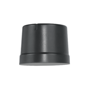
Type High Precision Smart Antennas Applicable Industry · UAV & Drone High-Precision Navigation & Heading
· Autonomous Robots & Unmanned Systems
· Precision Agriculture & Farm Machinery Navigation
· Surveying & Mapping & Geodetic Measurement
· Maritime Navigation & Vessel Heading
· Smart Port & Logistics Security Monitoring
· Automotive Autonomous Driving & Positioning
· Power Grid & Intelligent Transportation
· High-Precision Positioning Terminals Params Receiver Type:Multi-band RTK positioning & heading smart antenna module
Supported Constellations & Bands:BDS:B1I/B1C/B2a/B2I/B2b/B3I; GPS:L1C/A/L1C/L2PY/L2C/L5; GLONASS:L1CA/L2CA/L2P/L3 CDMA; Galileo:E1/E5a/E5b/E6; QZSS:L1C/A/L1C/B/L2C/L5/L6*
Hardware Channels:789 channels
Sensitivity: Tracking:-150dBm(20dB-Hz); Acquisition:-140dBm(30dB-Hz)
Time to First Fix: Cold Start:35s; Warm Start:10s; Recapture:1s; RTK Initialization:7s(baseline<30km)
Positioning Accuracy(RMS): 3D:Horizontal 1.5m,Vertical 2m; DGNSS:Horizontal 0.4m,Vertical 0.7m; RTK:Horizontal 0.6cm+0.5ppm,Vertical 1cm+1ppm
Heading Accuracy: 1m baseline:Heading 0.15°,Pitch/Roll 0.25°; 5m baseline:Heading 0.03°,Pitch/Roll 0.05°
Time & Speed Accuracy: PPS:1.4ns; Event:<3ns; Speed:3cm/s; Delay:<10ms(99.9%)
Max Update Rate:20Hz
Baud Rate: 4800bps~4Mbps (Default:115200bps)
Supported Protocols: NMEA 0183(v2.3/v3.03/v4.0); SBF; RTCM3.X(MSM included)
Antenna: Active antenna; Default passive antenna:φ35mm×25mm; Aux antenna gain:15~35dB
Interfaces: 8-pin connector(GND/TX2/PPS-RX2/SDA/SCL/TX1/RX1/VCC); Dual MCX antenna ports
Power Supply: 4.8~5.5V (Typical:5.0V)
Operating Current: Acquisition: 135190mA@5V; Tracking:133175mA@5V
Operating Temperature:-40℃ ~ +85℃
Storage Temperature: -45℃ ~ +85℃
Humidity:95%
Mechanical Dimensions: 48.0mm × 43.2mm × 37.0mm ±0.3mm; Weight:<24g Scope |
|||||||||
| JS-RK43-3 | High Precision Smart Antennas | Plastic + Metal | · UAV & Drone High-Precision Navigation · Intelligent Robots & Unmanned Equipment · Wearable Positioning Devices · Intelligent Logistics Dispatching · Automotive Navigation & Tracking · Power Grid & Electric Power Equipment · Precision Agriculture & Farm Machinery · Handheld High-Precision Terminals · Smart Transportation & Vehicle Networking | ||||||
|
Images
Type High Precision Smart Antennas Applicable Industry · UAV & Drone High-Precision Navigation
· Intelligent Robots & Unmanned Equipment
· Wearable Positioning Devices
· Intelligent Logistics Dispatching
· Automotive Navigation & Tracking
· Power Grid & Electric Power Equipment
· Precision Agriculture & Farm Machinery
· Handheld High-Precision Terminals
· Smart Transportation & Vehicle Networking Params Receiver Type:Dual-band (L1+L5) GNSS high-precision positioning module
Supported Constellations & Bands:GPS:L1/L5; BDS:B1I/B1C/B2I/B2B/B2A; Galileo:E1/E5; GLONASS:G1; QZSS:L1/L5; IRNSS:L5
Channel Configuration:200 tracking channels + dedicated search engine
Sensitivity:Tracking:-165dBm; Re-acquisition:-159dBm; Hot Start:-159dBm; Cold Start:-148dBm
Time to First Fix:Cold Start:28s; AGPS:1.5s; Hot Start:1s
Positioning Accuracy:Single-point:Horizontal 1.5m, Vertical 2.5m CEP; RTK:Horizontal 1.0cm+1ppm, Vertical 1.5cm+1ppm CEP
Time & Velocity Accuracy:PPS:<20ns RMS; Velocity:0.1m/s CEP
Operational Limits:Dynamics≤4g; Altitude≤18000m; Velocity≤515m/s
Baud Rate:115200~921600bps (Default:115200bps)
Max Update Rate:10Hz (Default:1Hz)
Supported Protocols:NMEA 0183; RTCM3.X
Antenna:Integrated helical active antenna; Φ35.00mm×H25.00mm
Pin Interfaces:8-pin:GND, TX2, RX2/PPS, SDA, SCL, TX1, RX1, VCC
Power Supply: VCC:3.35.5V (Typical:5.0V); Backup:1.83.6V
Operating Current: Average:45~65mA@5.0V; Backup:14uA@3.3V
Operating Temperature:-40℃ ~ +70℃
Storage Temperature:-40℃ ~ +70℃ Scope |
|||||||||
| JS-NK43-2 | High Precision Smart Antennas | Plastic + metal | · UAV & Drone High-Precision Navigation · Precision Agriculture & Automatic Lawn Mowers · Surveying & Mapping Equipment · Intelligent Robots & Unmanned Equipment · Automotive Electronics & Vehicle Positioning · Logistics & Security Monitoring · Smart Ports & Intelligent Transportation · Power Grid & Industrial Equipment · Handheld High-Precision Positioning Terminals | ||||||
|
Images
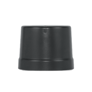
Type High Precision Smart Antennas Applicable Industry · UAV & Drone High-Precision Navigation
· Precision Agriculture & Automatic Lawn Mowers
· Surveying & Mapping Equipment
· Intelligent Robots & Unmanned Equipment
· Automotive Electronics & Vehicle Positioning
· Logistics & Security Monitoring
· Smart Ports & Intelligent Transportation
· Power Grid & Industrial Equipment
· Handheld High-Precision Positioning Terminals Params Receiver Type:Multi-system multi-frequency RTK positioning + dual-antenna heading module
Supported Constellations & Bands:BDS:B1I/B2I/B3I; GPS:L1C/A/L1C/L2P(Y)/L5; GLONASS:L1/L2; Galileo:E1/E5a/E5b; QZSS:L1/L2/L5; SBAS
Channel Configuration: 1408 super channels
Time to First Fix:Cold Start:<30s (-130dBm, ≥12 satellites)
Positioning Accuracy (RMS):3D:Horizontal 1.5m, Vertical 2.5m; DGPS:Horizontal 0.4m+1ppm, Vertical 0.8m+1ppm; RTK:Horizontal 1.5cm+1ppm, Vertical 2.0cm+1ppm
Time & Velocity Accuracy:Time(RMS):20ns; Velocity(RMS):0.03m/s
RTK Initialization Time:<5s (Typical)
Max Update Rate:20Hz
Baud Rate:9600~921600bps (Default:115200bps)
Supported Protocols:Data:NMEA 0183; Differential:RTCM3.3/3.2/3.1/3.0
Antenna:Integrated high-gain helical active antenna
Pin Interfaces:8-pin:GND, TX2, PPS/RX2, SDA, SCL, TX1, RX1, VCC
Power Supply:3.3~5.5V (Typical:5.0V)
Operating Current:180mA~310mA@3.3V
Storage/Operating Temperature:Storage:-40-85℃; Operating:-40-85℃
Humidity:95%
Mechanical Dimensions:48.0mm × 43.2mm × 37.0mm ±0.3mm Scope |
|||||||||
| JS-HAC18A-F | High Precision Helical GNSS Antenna for UAV | Plastic, Metal | •Light-duty UAV aerial survey/mapping/remote telemetry •High-precision surveying and geodetic measurement •Vehicle/airborne navigation and dispatching •Traffic patrol and security surveillance •Disaster monitoring and emergency command •UAV security inspection •High-precision positioning terminals | ||||||
|
Images
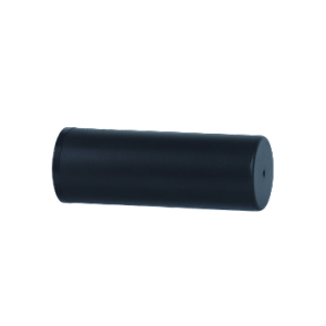
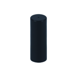
Type High Precision Helical GNSS Antenna for UAV Applicable Industry •Light-duty UAV aerial survey/mapping/remote telemetry
•High-precision surveying and geodetic measurement
•Vehicle/airborne navigation and dispatching
•Traffic patrol and security surveillance
•Disaster monitoring and emergency command
•UAV security inspection
•High-precision positioning terminals Params Antenna Type: Helical GNSS Active Antenna
Received Signals: GPS(L1/L2/L5), BDS(B1/B2), GLONASS(G1/G3), Galileo(E1/E5a/E5b), QZSS(L1/L2/L5), SBAS(L1/L5), IRNSS(L5)
Impedance: 50Ω
Polarization: Right-Hand Circular Polarization (RHCP)
Axial Ratio: ≤3dB
Horizontal Coverage: 360°
VSWR: ≤2.0
LNA Gain: 33±2dB
Noise Figure: ≤2dB
Operating Voltage: +2.8~3.3V DC
Operating Current: ≤30mA
Dimensions: Φ18mm × H50.8mm
Weight: 10.8g
Connector: SMA Male Straight
Mounting SMA: Threaded Mount
Waterproof Rating:IP65 (with mated SMA connector)
Operating Temperature: -30℃ ~ +70℃
Storage Temperature: -35℃ ~ +75℃
Humidity: 0%~95% Non-condensing
Compliance: RoHS Scope |
|||||||||
| JS-NK43-1 | High Precision Smart Antennas | Plastic, Metal | · UAV & Drone High-Precision Navigation & Control · Automotive Autonomous Driving & Vehicle Positioning · Precision Agriculture & Farm Machinery Automatic Navigation · Intelligent Robots & Unmanned Mobile Equipment · Surveying & Mapping & Geodetic Measurement · Smart Logistics & Asset Tracking & Fleet Management · Maritime Navigation & Vessel Positioning · Industrial Monitoring & High-Dynamic Positioning Terminals | ||||||
|
Images
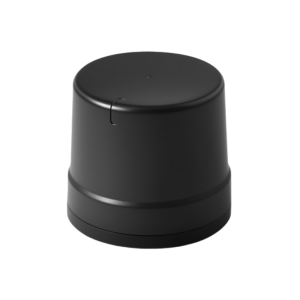
Type High Precision Smart Antennas Applicable Industry · UAV & Drone High-Precision Navigation & Control
· Automotive Autonomous Driving & Vehicle Positioning
· Precision Agriculture & Farm Machinery Automatic Navigation
· Intelligent Robots & Unmanned Mobile Equipment
· Surveying & Mapping & Geodetic Measurement
· Smart Logistics & Asset Tracking & Fleet Management
· Maritime Navigation & Vessel Positioning
· Industrial Monitoring & High-Dynamic Positioning Terminals Params Receiver Type: Multi-band multi-mode RTK GNSS positioning module (with INS integration)
Supported Constellations & Bands: GPS: L1C/A, L2C, L5; BDS: B1I, B1C, B2a, B2b, B3I; GLONASS: G1, G2, G3; Galileo: E1, E5a, E5b, E6; QZSS: L1, L2, L5; SBAS
Channel Configuration: 120 search channels + 80 tracking channels
Sensitivity: Tracking: -166dBm; Acquisition: -149dBm; Reacquisition: -160dBm
Time to First Fix: Cold Start: ≤30s; Warm Start: ≤12s; Hot Start: ≤1s; RTK Initialization: ≤6s (baseline <10km)
Positioning Accuracy: Single-point: Horizontal 1.8m, Vertical 3.5m (CEP, PDOP≤4); DGNSS: 0.4m; RTK: Horizontal 1cm+1ppm, Vertical 2cm+1ppm (RMS)
Inertial Navigation Parameters: IMU: Six-axis (3-axis gyro + 3-axis accelerometer); Gyro range: ±250°/s; Acceleration range: ±4g; Dead reckoning error: ≤3% of travel distance
Max Update Rate: RTK/Positioning: 20Hz; IMU: 50Hz
Baud Rate: 9600~921600bps (Default: 115200bps)
Supported Protocols: NMEA 0183 V4.1/V4.2; RTCM 2.X/3.X (MSM3~MSM7); Private binary protocol
Antenna: Built-in active antenna; φ42mm×28mm; Gain: 28~38dB; Impedance: 50Ω
Interfaces: 2×UART (TX/RX), I2C, 1PPS, RESET_N, VCC, GND, RF_IN
Power Supply: 4.5~5.5V (Typical: 5.0V)
Operating Current: Acquisition: 140~190mA@5V; Tracking: 130~180mA@5V; Standby: 25mA@5V
Operational Limits: Dynamics ≤4g; Altitude ≤20000m; Velocity ≤500m/s
Operating Temperature: -40℃ ~ +85℃
Storage Temperature: -40℃ ~ +105℃
Humidity: 95% (non-condensing)
Mechanical Dimensions: φ43.0mm×37.5mm±0.5mm
Compliance: RoHS, CE Scope |
|||||||||
| JS-MK43 | High Precision Smart Antennas | Plastic, Metal | · Autonomous Driving & Assisted Driving · UAV & Drone Navigation · Agricultural Automation & Precision Farming · Vehicle Management & Fleet Monitoring · Intelligent Robot & Unmanned Equipment · Smart City & Intelligent Traffic · Intelligent Safety Testing & Industrial Detection · Precision Positioning Terminals | ||||||
|
Images
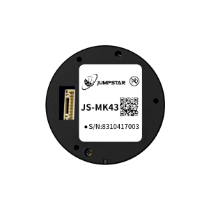
Type High Precision Smart Antennas Applicable Industry · Autonomous Driving & Assisted Driving
· UAV & Drone Navigation
· Agricultural Automation & Precision Farming
· Vehicle Management & Fleet Monitoring
· Intelligent Robot & Unmanned Equipment
· Smart City & Intelligent Traffic
· Intelligent Safety Testing & Industrial Detection
· Precision Positioning Terminals Params Receiver Type:Multi-band multi-mode GNSS RTK positioning module
Supported Constellations & Signals: GPS/QZSS:L1C/A,L2C; GLONASS:G1,G2; BDS:B1I,B2I(Incl. BDS-3)
Channel Configuration: 96 search channels; 60 tracking channels
Sensitivity: Tracking:-163dBm; Reacquisition:-147dBm
Time to First Fix: Cold Start:≤35s; Warm Start:20s; Hot Start:1s
Positioning Accuracy: Autonomous:2.0m CEP; DGNSS:0.5m CEP; RTK:2cm+1ppm(Horizontal)
Time & Velocity Accuracy: 1PPS(RMS):25ns; GNSS:0.1m/s; D-GNSS:0.05m/s
Operational Limits: Dynamics≤4g; Altitude≤18000m; Velocity≤515m/s
Max Update Rate: 10Hz (Default:1Hz)
Baud Rate: 115200~230400bps (Default:115200bps)
Supported Protocols: NMEA 0183 V4.0/V4.1; RTCM 3.X; JMS
Antenna: Integrated active antenna; Default:φ35mm×25mm
Interfaces: 2×UART, I2C, 1PPS, VCC, GND
Power Supply: 3.3~5.5V (Typical:5.0V)
Operating Current: Acquisition:130180mA@5V; Tracking:120170mA@5V
Operating Temperature: -40℃ ~ +85℃
Humidity: 95%
Mechanical Dimensions: Bottom diameter:47.2mm; Head diameter:42.3mm; Height:36.8mm±0.3mm
Compliance: RoHS compliant Scope |
|||||||||
| JS-CK43-2 | High Precision Smart Antennas | Plastic, Metal | · UAV & Drone High-Precision Navigation · Surveying & Mapping Equipment · Automotive Autonomous Driving · Intelligent Robots & Unmanned Equipment · Precision Agriculture & Farm Machinery · Smart Port & Logistics Security · Maritime Navigation & Positioning · Power Grid & Industrial Monitoring · Smart Transportation & Vehicle Networking · High-Precision Positioning Terminals | ||||||
|
Images
Type High Precision Smart Antennas Applicable Industry · UAV & Drone High-Precision Navigation
· Surveying & Mapping Equipment
· Automotive Autonomous Driving
· Intelligent Robots & Unmanned Equipment
· Precision Agriculture & Farm Machinery
· Smart Port & Logistics Security
· Maritime Navigation & Positioning
· Power Grid & Industrial Monitoring
· Smart Transportation & Vehicle Networking
· High-Precision Positioning Terminals Params Receiver Type: Multi-band multi-mode RTK+INS integrated positioning module
Supported Signals: GPS:L1C/A,L1C,L2P,L2C,L5; BDS-2/3:B1I,B1C,B2a,B2b,B3I; GLONASS:G1,G2,G3; Galileo:E1,E5a,E5b,E6; QZSS:L1C/A,L2C,L5,L1C; IRNSS:L5; SBAS:L1C/A,L5
Sensitivity: Tracking:-155dBm; Acquisition:-140dBm
Time to First Fix: Cold Start:20s; Warm Start:10s; Loss Reacquisition:1s
Positioning Accuracy: Single-point:Horizontal 1.5m,Vertical 3m(1σ,PDOP≤4); RTK(RMS):Horizontal 0.8cm+1ppm,Vertical 1.5cm+1ppm
Measurement Accuracy: Pseudorange:≤10cm; Carrier phase:≤1mm
Timing & Velocity Accuracy: PPS(RMS):20ns; Velocity:≤0.02m/s
Inertial Parameters: Gyro:±125°/s,zero bias 0.5°/s; Acceleration:±2g,zero bias 20mg; Dead reckoning error:3%d
RTK Initialization: <5s (baseline length <10km)
PPP Performance: Initialization:20min; Accuracy:Horizontal 0.1m,Vertical 0.2m
Max Update Rate: Positioning/RTK:50Hz; IMU:100Hz
Baud Rate: 115200~921600bps (Default:115200bps)
Supported Protocols: NMEA 0183; CNB(private binary); CMR; RTCM2.X/3.X(MSM3~MSM7)
Antenna Integrated: Active antenna; φ35mm×25mm
Interfaces: 2×UART, I2C, PPS, VCC, GND
Power Supply: 4.8~5.5V (Typical:5.0V)
Operating Current: Acquisition:135185mA@5V; Tracking:125175mA@5V
Operating Temperature: -40℃ ~ +85℃
Humidity: 95%
Mechanical Dimensions: 48.0mm × 43.2mm × 37.0mm ±0.5mm
Compliance: RoHS compliant Scope |
|||||||||
| G27SH-AH | All-Constellation All-Frequency GNSS Receiver | Plastic, Metal | · UAV & Drone High-Precision Navigation · Geological Disaster Real-Time Monitoring · Intelligent Logistics Dispatch & Asset Tracking · Autonomous Robots & Unmanned Equipment · Vehicle-Mounted Autonomous Driving · Geomatics & Surveying Mapping · Precision Agriculture & Farm Machinery Navigation · Precision Industrial Control · Maritime Navigation & Heading Output · Urban Intelligent Transportation | ||||||
|
Images
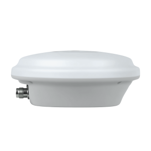
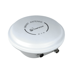
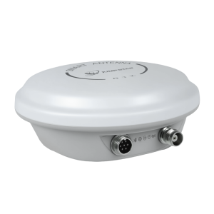
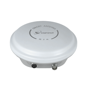
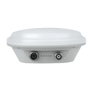
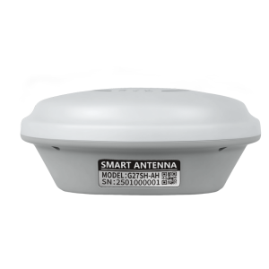
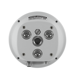
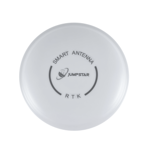
Type All-Constellation All-Frequency GNSS Receiver Applicable Industry · UAV & Drone High-Precision Navigation
· Geological Disaster Real-Time Monitoring
· Intelligent Logistics Dispatch & Asset Tracking
· Autonomous Robots & Unmanned Equipment
· Vehicle-Mounted Autonomous Driving
· Geomatics & Surveying Mapping
· Precision Agriculture & Farm Machinery Navigation
· Precision Industrial Control
· Maritime Navigation & Heading Output
· Urban Intelligent Transportation Params Receiver Type: All-constellation all-frequency GNSS positioning & heading receiver
Supported Signals: GPS:L1C/A,L1C,L2C,L2PY,L5; BDS:B1I,B1C,B2a,B2I,B2b,B3I; GLONASS:L1CA,L2CA,L2P,L3; Galileo:E1,E5a,E5b,E6; QZSS:L1C/A,L1C/B,L2C,L5,L6; NavIC; SBAS
Hardware Channels: 789 channels
Sensitivity Tracking: 20dB-Hz; Acquisition: 30dB-Hz
Time to First Fix: Cold Start:<35s; Warm Start:<10s; RTK Initialization:7s
Positioning Accuracy: RTK:Horizontal 0.6cm+0.5ppm; Standalone:1.2m; DGNSS:0.4m
Heading Accuracy: 1m baseline:0.15°; 5m baseline:0.03°
Timing & Event Accuracy: xPPS:1.4ns; Event:<3ns
Signal Latency: 99.9% <10ms
Velocity Accuracy: 0.03m/s
Max Update Rate: 20Hz
Baud Rate: 4800bps~4Mbps (Default:115200bps)
Radio (Optional): 410~470MHz, Half Duplex, CSS, Sensitivity:-129dBm, Distance:5km
Power Consumption: Receive:0.170.18W; Transmit:0.180.5W
Power Supply: 3.5~12.0V (Typical:5V)
Operating Current: 172~193mA@5.0V
ESD Protection: 2000V (HBM)
Operating Temperature: -40℃ ~ +85℃
Protection Level: IP67 waterproof & dustproof
Interfaces: 2×UART, PPS, CAN, RF(TNC), GX12 aviation plug
Storage: Built-in TF card slot, max support 32GB
Compliance: RoHS compliant Scope |
|||||||||
Certifications & Compliance
Each record can become a certification entity page.
| Certification | Cert Number | Standard | Authority | Market | Issue Date | Expiry Date | Document |
|---|---|---|---|---|---|---|---|
| ISO9001:2015 | UQ231801R2 | ISO9001:2015 | Beijing United Intelligence Certification Co.,Ltd. | EU,USA, Middle East, Africa, Asia | 2023-12-11 | 2026-12-10 |
Applications & Industries
Taxonomy-backed tags to form industry ↔ supplier ↔ product relationships.
| Industry | Country | Working Condition | Project Type | Function | Operation Mode | Special Requirement | Matched Equipment |
|---|---|---|---|---|---|---|---|
| Fleet Management | CN,JP,SG,GLOBAL | The device is fixedly mounted inside various types of vehicles, including autonomous vehicles, construction machinery, agricultural machinery, logistics trucks, and special inspection vehicles. It is powered by a 4.5V–12V DC vehicle power supply. Its operating temperature ranges from –40°C to +85°C, and its storage temperature from –55°C to +85°C, making it suitable for outdoor driving environments in extreme cold and heat across both northern and southern regions. The vehicle's dynamic speed limit is 515 m/s, with a maximum acceleration/deceleration of 4g, and the device must withstand sustained high‑frequency vibrations from the engine and road surfaces over long‑term operation. During daily driving, it passes through urban high‑rise canyons, tunnels, elevated roads, and mountain forest roads, encountering complex signal environments that include electromagnetic interference from vehicle electronics, multipath reflections from buildings, and external man‑made RF jamming. It operates | Vehicle Positioning | Built for Extreme Vehicle Environments Fixed mount inside any vehicle type (autonomous, construction, agricultural, logistics, inspection). Wide input voltage (4.5–12V DC) and ultra‑wide temperature range (–40°C to +85°C operating, –55°C to +85°C storage). Withstands 4g acceleration, 515 m/s speed, and continuous engine/road vibration. Reliable in high humidity (≤95% non‑condensing) and at altitudes up to 18,000 m. Precision Positioning & Attitude Full‑band tracking of all six major GNSS constellations (GPS, BeiDou, Galileo, GLONASS, QZSS, NavIC). Centimeter‑level RTK accuracy for autonomous steering and navigation. Dual‑antenna version (P‑Box‑AP55H) delivers real‑time heading, pitch, and roll for lane keeping and auto‑steering. Smart Signal Assurance Built‑in AIM+ anti‑jamming, IONO mitigation, APME multipath elimination, and RAIM integrity. Stable satellite lock even in tunnels, urban canyons, and under dense foliage. Native Galileo OSNMA anti‑spoofing protection guards against fak | Upon vehicle power‑on, the device automatically starts up via Micro USB or the hardware UART interface. It supports two operating modes: onboard RTK rover and roadside static base station. The device automatically scans all frequency bands of the six GNSS constellations to acquire and track satellite signals. It can connect to an onboard 4G terminal via USB or TTL serial port to access NTRIP/CORS differential services and receive RTCM differential correction data in real time. It continuously outputs NMEA, SBF, and RTCM positioning and attitude messages to external devices. The TF card automatically logs raw satellite observation data offline. Configuration of satellite tracking, anti‑jamming, and differential output parameters can be performed through three methods: the web management interface, RxTools host software, and serial commands. All settings can be saved to the startup configuration and are retained after power‑off, ensuring long‑term unattended continuous positioning operat | 1.Full multi‑constellation and multi‑frequency band parallel reception, completely covering mainstream frequency points including GPS L1/L2/L5, BeiDou B1/B2/B3, Galileo E1/E5/E6, etc. 2.Built‑in multi‑layer anti‑jamming algorithms including wideband automatic suppression, adaptive narrowband notch filtering, and multipath mitigation, capable of resisting electromagnetic interference from vehicle electronics and external RF sources. 3.Supports dual security mechanisms: OSNMA satellite anti‑spoofing and RAIM receiver integrity monitoring. 4.Industrial‑grade wide temperature operating range with excellent vibration resistance, suitable for long‑term vehicle operation under rough road conditions. 5.Up to 100 Hz raw satellite observation output with positioning latency <10 ms. 6.Dual‑antenna version achieves heading accuracy up to 0.03°, meeting lane‑keeping requirements for autonomous driving. 7.Built‑in local TF storage enables high‑precision trajectory recovery via PPK post‑processing ev | The system comprises: Vehicle‑mounted autonomous driving domain controller / onboard industrial computer, automotive‑grade active GNSS single/dual antenna, vehicle‑mounted DC step‑down power supply, vehicle‑mounted 4G NTRIP differential communication module, TF data storage card, vehicle communication harness, vehicle display terminal, RxTools debugging computer, and ground‑based CORS differential service platform. |
| UAV | CN,IN,AE,BE,GLOBAL,KR | The device is airborne‑mounted on aerial surveying UAV platforms. Its operating temperature ranges from –40°C to +85°C, and storage temperature from –45°C to +85°C, with ambient humidity ≤95% (non‑condensing). It is capable of adapting to a maximum flight altitude of 18,000 m, flight acceleration ≤4g, and a maximum flight speed of 515 m/s. It is designed for long‑term field operations in open environments, with significant day‑night temperature variations, and operates in complex electromagnetic environments such as urban canyons, forests, and suburban areas, where wideband, narrowband, and pulsed GNSS interference may exist. The unit is powered by a 4.5–12V DC lithium battery, supporting continuous round‑the‑clock operation. It features vibration resistance and stable performance under extreme high and low temperatures. | Aerial Surveying & Mapping UAV | 1.Full-system multi-frequency GNSS centimeter-level RTK high-precision positioning, providing real-time geographic coordinates for aerial surveying and mapping. 2.Dual-antenna version outputs high-precision heading and attitude, ensuring accurate trajectory reproduction and proper overlap of aerial images. 3.Built-in 4G full-network module supports access to CORS/NTRIP differential services, receives RTCM differential data in real time, enabling RTK fixed solutions during flight. 4.Equipped with AIM+ full-dimensional anti-jamming, IONO ionospheric mitigation, and APME multipath mitigation algorithms, ensuring stable satellite acquisition in complex field interference environments. 5.Supports Galileo OSNMA anti-spoofing to prevent forged signals from causing mapping coordinate drift. 6.100 Hz raw observation and up to 20 Hz RTK positioning output, with ultra-low latency <10 ms, suitable for high-speed aerial flights. 7.Outputs 1PPS high-precision synchronization pulse, matching the expo | The device is fixedly installed onboard and automatically starts upon UAV power‑on. It can be flexibly configured in two operating modes: RTK rover or static base station. After startup, the built‑in 4G module automatically dials up to connect to the NTRIP differential server and continuously receives RTCM3.x differential correction messages. In real time, it outputs NMEA/SBF positioning and attitude data to the UAV flight controller via the serial port. It supports remote parameter modification via SMS or the 4G web management interface. Throughout the entire operation, the TF card automatically logs raw satellite observation data. All configuration parameters are automatically saved upon shutdown, enabling all‑weather unattended continuous aerial surveying missions. | 1.Equipped with AIM+ composite anti‑jamming capability, automatically suppressing wideband interference, adaptively notching out narrowband RF interference, combined with multipath mitigation algorithms. 2.Supports Galileo OSNMA satellite navigation anti‑spoofing authentication, mitigating the risk of man‑made forged satellite signals. 3.Built‑in global full‑band 4G communication module, enabling remote access to differential data and remote device configuration without the need for an external differential radio. 4.High‑dynamic hardware architecture supports stable satellite tracking under ≤4g acceleration and 515 m/s high‑speed flight conditions. 5.Industrial‑grade ultra‑wide temperature operating range, ensuring long‑term stable operation in harsh, hot, and cold field surveying environments. 6.Dual‑antenna version achieves heading accuracy as low as 0.03°, ensuring stable long‑distance flight paths without deviation. 7.Multi‑protocol compatibility: NMEA0183, SBF, RINEX, RTCM V2/V3, | Aerial surveying UAV flight control system, airborne visible‑light/multispectral surveying camera, UAV power lithium battery, single/dual‑array GNSS antennas, 4G data SIM card, ground‑based CORS differential reference station, computer (with RxTools debugging software), TTL/USB communication data cable, TF data storage card, and external RF feed cable. |
Industries (2) → Products (50 models) → Certifications (1)
Manufacturing Capabilities
Core processes and equipment available in-house.
Customization
Modules, PCBA, Antennas, functions, ports, interfaces, logo.
Monthly Capacity
50,000 units
Lead Time
30 days
Export Markets
EU, Middle East, USA
After Sales
Remote support
Quality Control
100% test
Project References / Cases
Verified project records. Client names anonymized where requested.
| Client Type | Country | Quantity | Application | Duration | Result | Highlight |
|---|---|---|---|---|---|---|
| Drone manufacturer | IN,CN,GLOBAL,AE,CZ | 500 units | GNSS Positioning For Drone | 5 years | It delivers centimeter-level RTK positioning and high-precision attitude output without relying on magnetic sensors, performing reliably under both static and dynamic conditions. Equipped with industrial-grade AIM+ anti-jamming and anti-spoofing technology, it ensures stable operation in complex electromagnetic environments. It integrates TCXO, LNA and a 32GB TF card slot, and features rich interfaces including Ethernet, triple UART and Type-C. Supporting both base station and rover station modes, it is widely used in drones, precision agriculture, autonomous robots, autonomous driving and other high-precision positioning fields. | 544 Hardware Channels: Simultaneously track all visible satellite signals for full-coverage positioning Triple-Band Multi-Constellation: Supports GPS, BDS, GLONASS, Galileo, QZSS, NavIC, SBAS triple-frequency signals Dual-Antenna High-Precision Heading: Heading accuracy up to 0.03°@5m baseline, no magnetic sensor dependency 100Hz Ultra-High Update Rate: Position & observation output at 100Hz, <10ms ultra-low latency AIM+ Multi-Layer Anti-Jamming: AIM+/IONO+/Lock+/APME+/RAIM+ for stable positioning in complex environments Rich Communication Interfaces: 3×UART, Ethernet, Type-C, TF card slot for flexible integration High Integration Miniature Design: Built-in TCXO, LNA, 32GB TF card slot, compact 74×50×12.6mm size Base/Rover Dual-Mode: Flexible switching between base station and rover station modes Industrial-Grade Reliability: -40℃+85℃ wide temperature, 4.512V wide voltage input Advanced Security: Supports OSNMA anti-spoofing, interference monitoring & spectrum measu |
Comparative Positioning
Side-by-side benchmarks against peer manufacturers in this segment.
| Compared To | Difference | Performance Gap | Best For | Cost Difference | Efficiency |
|---|---|---|---|---|---|
| Beitian (e.g., UM982 RTK Board/Module) | Turnkey integrated receiver vs. bare core component | 80% shorter deployment time | Port logistics, precision agriculture, heavy-duty vehicle retrofitting | 40% lower total project R&D cost | Comparable power consumption (<3W), but better anti-interference stability in harsh RF environments |
Risk & Trust Signals
Aggregated data-driven indicators. Not an endorsement.
Purchase & Trade Information
Trading terms and procurement details.
Product Comparison
Comparative analysis against alternative solutions.
| Compared To | Difference | Performance Gap | Best For | Cost Difference | Efficiency |
|---|---|---|---|---|---|
| Beitian (e.g., UM982 RTK Board/Module) | Turnkey integrated receiver vs. bare core component | 80% shorter deployment time | Port logistics, precision agriculture, heavy-duty vehicle retrofitting | 40% lower total project R&D cost | Comparable power consumption (<3W), but better anti-interference stability in harsh RF environments |