High Precision GNSS Solutions for Project Deployment: An Application-by-Application Selection Guide
Buyer Stage: Research → Evaluation | Published: August 2026
High-precision GNSS solutions deliver centimeter-level positioning for UAVs, precision agriculture, autonomous vehicles, robotics, fleet management, surveying and mapping, and marine navigation. This guide explains how to match them to a specific project.
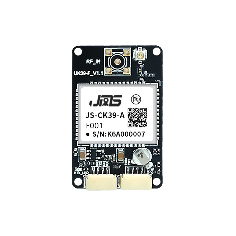
Figure 1. High-precision GNSS hardware is available as embedded RTK boards, integrated receivers, smart antennas, and antennas.
Why a High-Precision GNSS Solution Is a Project Decision, Not Just a Component Choice
Selecting a high-precision GNSS solution during the research and evaluation stage determines whether a UAV, agricultural machine, autonomous vehicle, or fleet platform can maintain reliable centimeter-level accuracy under its real operating conditions. The right choice depends on the deployment environment, the required accuracy, the update rate, the integration interface, and the risk of signal interference. No single receiver fits every project; the evaluation must start from the application and its constraints.
High-precision GNSS solutions differ from standard GPS modules mainly in the use of multi-constellation, multi-band signals, RTK (Real-Time Kinematic) or PPP corrections, and additional functions such as dual-antenna heading, IMU integration, anti-jamming, and anti-spoofing. A project using these systems typically needs positioning or navigation output at the centimeter level, combined with stable operation in harsh environments. Defining the project type first makes the rest of the hardware selection measurable.
What Problem a High-Precision GNSS Solution Solves
Standard GNSS positioning, typically using a single frequency and a single constellation, often delivers meter-level accuracy. That is enough for navigation but not enough for applications where a machine must act on its position: an agricultural vehicle steering row by row, a drone following a pre-planned flight line, an autonomous vehicle deciding its lane position, or a fleet system logging precise movement. High-precision GNSS closes the gap by combining multiple constellations, multiple frequency bands, and differential correction techniques to reach centimeter-level accuracy.
The core problems addressed by high-precision GNSS solutions are:
- Positioning accuracy — RTK solutions typically reach horizontal accuracy of 0.6 cm + 0.5 ppm to 2 cm + 1 ppm depending on the receiver, antenna, and baseline conditions.
- Heading and attitude — dual-antenna receivers provide heading accuracy of 0.15° at a 1 m baseline and 0.03° at a 5 m baseline without relying on magnetic sensors.
- Continuity in difficult signal environments — urban canyons, tree cover, tunnels, and electromagnetic interference may interrupt standard satellite lock; anti-jamming, multipath mitigation, and IMU dead reckoning improve continuity.
- Security and integrity — anti-spoofing mechanisms such as Galileo OSNMA help prevent forged satellite signals from shifting coordinates.
- Data rate and latency — high-dynamic platforms such as UAVs need high update rates, up to 100 Hz for position and observation output in some receivers, with latency below 10 ms.
In short, the problem a high-precision GNSS solution solves is not merely accuracy, but accurate positioning that remains reliable when the platform is moving, vibrating, exposed to interference, or operating in a demanding environment.
Market and Industry Background
The global high-precision GNSS market was valued at USD 7.8 billion in 2024 and is projected to reach USD 20.6 billion by 2033, according to Dataintelo. The high-precision GNSS module segment was estimated at USD 1.5 billion in 2024 and is forecast to reach USD 4.5 billion by 2035, based on Market Research Future data. The GNSS downstream market is forecast to reach €580 billion by 2034, according to EUSPA.
Agriculture is the dominant application segment for high-precision GNSS, holding a 36.8% market share in 2025, according to the High-Precision GNSS Market Research Report 2034. The global precision farming market is projected to grow from USD 11.38 billion in 2025 to USD 21.45 billion by 2032, based on MarketsandMarkets data. These figures illustrate why project-level selection matters: as high-precision GNSS moves into agriculture, autonomous systems, and fleet operations, buyers must choose hardware for the environment and workflow, not for the label alone.
At the standards level, Galileo High Accuracy Service (HAS) delivers horizontal accuracy down to 20 cm, and ISO 12188 parts 1 and 2 define test procedures for positioning and guidance systems in agriculture and forestry. These references help engineering teams define acceptance criteria before procurement.
High-Precision GNSS Solutions by Application
High-Precision GNSS Solutions for UAVs
UAV platforms for aerial surveying and mapping require GNSS receivers that maintain RTK fixed solutions during flight, support high dynamics, and integrate easily with flight controllers. The operating conditions for an aerial surveying UAV include temperatures from –40°C to +85°C, flight acceleration up to 4g, maximum flight speed of 515 m/s, and complex electromagnetic environments such as urban canyons and forest areas. The receiver must provide real-time geographic coordinates for photogrammetry, and a dual-antenna version can output heading and attitude to keep flight lines stable and image overlap consistent.
Receivers used in UAV applications often need the following capabilities, all documented in Jumpstar hardware:
- Multi-constellation, multi-band RTK positioning with horizontal accuracy of 0.6 cm + 0.5 ppm.
- Built-in 4G module for accessing CORS/NTRIP differential services, removing the need for an external differential radio.
- AIM+ anti-jamming, IONO+ ionospheric mitigation, and APME+ multipath suppression for stable lock in field environments.
- Galileo OSNMA anti-spoofing to prevent forged signals from causing coordinate drift.
- 100 Hz raw observation output, up to 20 Hz RTK positioning, and 99.9% of signal latency below 10 ms.
- 1PPS output for sensor synchronization.
For UAV projects, the evaluation should cover: RTK initialization time, update rate, interface compatibility with the flight controller, whether the receiver can act as a rover or base station, and whether the antenna is light enough for the airframe. A compact dual-antenna receiver such as the P-Box-X10, with 544 hardware channels, dual-antenna heading up to 0.03° at a 5 m baseline, and a 74 × 50 × 12.6 mm form factor, is designed for this type of deployment.
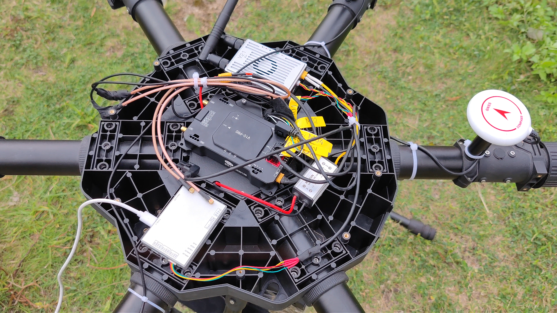
Figure 2. A drone manufacturer’s long-running deployment uses the P-Box-X10 for RTK positioning, heading output, and anti-jamming in complex electromagnetic environments.
High-Precision GNSS Solutions for Precision Agriculture
Precision agriculture is the largest application segment for high-precision GNSS, with a 36.8% market share in 2025. Agricultural machinery such as tractors, sprayers, and harvesters needs auto-steering with repeatable sub-decimeter accuracy, plus robustness against dust, vibration, wide temperature swings, and partial sky obstruction. RTK horizontal accuracy of 0.6 cm + 0.5 ppm is sufficient for guided row operations, while dual-antenna heading supports stable vehicle orientation without magnetic sensor errors.
The P-Box-AP55 is a multi-constellation multi-band GNSS receiver that fits precision agriculture machinery. It provides RTK horizontal accuracy of 0.6 cm + 0.5 ppm, RTK vertical accuracy of 1 cm + 1 ppm, a position-only update rate of 100 Hz, and RTK + attitude output at 20 Hz. The AP55H version supports heading accuracy of 0.15° at a 1 m baseline and 0.03° at a 5 m baseline. Its operating voltage of 4.5–12 V DC matches vehicle power systems, and its operating temperature range of –40°C to +85°C supports long field work.
For agricultural projects, the decision criteria include: the required pass-to-pass accuracy, the correction source (private base station, CORS network, or satellite corrections), the tractor’s power and cabling constraints, and whether the receiver can log data for post-processing backup. A support issue that often appears later is the quality of the antenna: the phase center error affects accuracy directly. Antennas such as the JS-HAC100B and JS-YAC130N are built for high-precision measurement and can be paired with receivers for survey-grade work.
High-Precision GNSS Solutions for Autonomous Vehicles
Autonomous and assisted driving systems require continuous high-precision positioning and increasingly need heading, pitch, and roll for lane keeping and vehicle control. The working environment for vehicle-mounted GNSS includes urban high-rise canyons, tunnels, elevated roads, and mountain forest roads, with electromagnetic interference from vehicle electronics, multipath reflection from buildings, and potential external RF jamming. Receivers for this application need a wide input voltage range, wide temperature operation, anti-jamming, and optional IMU integration to bridge signal gaps.
A dual-antenna receiver such as the P-Box-X10 provides heading accuracy of 0.15° at a 1 m baseline and 0.03° at a 5 m baseline, and supports RTK horizontal accuracy of 0.6 cm + 0.5 ppm. The X43H-AH, with 789 hardware channels and dual-antenna heading, is another option for vehicle-mounted positioning and autonomous driving control. For projects that need compact embedded hardware, the JS-CK39-A RTK board integrates a built-in IMU and delivers RTK accuracy of H ±(8 + 1 ppm × D) mm and V ±(15 + 1 ppm × D) mm.
Autonomous vehicle projects should also evaluate resistance to jamming and spoofing. The JS-X168 is a five-array anti-jamming GNSS receiver with integrated anti-jamming antenna, providing 115 dB anti-jamming capability against a single interference source and 95 dB against three sources. It is designed for high-security positioning scenarios, including airborne and vehicle systems where a lost or manipulated signal could create safety risk.
High-Precision GNSS Solutions for Robotics and AGVs
Autonomous robots and AGVs operate in structured industrial environments, ports, warehouses, and outdoor compounds. Their GNSS requirements include centimeter-level positioning, stable heading, and the ability to recover position when satellite signals are briefly blocked. GNSS+INS integration is especially useful for this application because the inertial sensor maintains a usable position during short signal loss before GNSS lock returns.
Small and embedded RTK modules are a fit for robotics. The JS-ARK37-3 is a full-system dual-frequency high-precision RTK GNSS antenna module with 200 tracking channels, RTK horizontal accuracy of 1.0 cm + 1 ppm, and an operating temperature range of –40°C to +85°C. Its intended industries include autonomous robots, inspection robots and mobile robot navigation, and precision control. The JS-RK26-U, a dual-band (L1+L5) GNSS+INS integrated module, provides RTK horizontal accuracy of 1.0 cm + 1 ppm and sustains a positioning error of ≤5% of travel distance during 120 seconds of GNSS loss.
For robotics projects, mechanical size and power consumption often carry as much weight as raw accuracy. A compact module such as the JS-ARK28-3 measures 28.0 × 28.0 × 8.0 mm and weighs less than 12 g, making it possible to embed into a robot controller without a separate enclosure.
High-Precision GNSS Solutions for Fleet Management and Vehicle Tracking
Fleet management projects differ from other applications because they prioritize continuous tracking, wide-area coverage, and system cost per vehicle. Some fleet vehicles need only meter-level or sub-meter positioning, but advanced fleet applications such as autonomous trucks, port container operations, construction machinery tracking, and special inspection vehicles need RTK-level accuracy and reliable attitude output. The vehicle-mounted environment includes 4.5–12 V DC power, temperatures from –40°C to +85°C, vibration from the engine and road surface, and operation through urban canyons and tunnels.
For vehicles that require centimeter-level positioning or dual-antenna heading, the P-Box-AP55, P-Box-X6_Pro S, and G27SH-AH are relevant. The P-Box-X6_Pro S includes a global 4G module (EG25-G) for RTCM data transmission, OSNMA anti-deception, TF card logging, anti-jamming, and heading output. The G27SH-AH is an all-constellation all-frequency receiver with heading accuracy of 0.15° at a 1 m baseline and 0.03° at a 5 m baseline, IP67 protection, CAN interface, and optional internal radio. For standard fleet tracking without RTK, modules such as the JS-TP26-U provide GNSS+INS integration with a small 16.0 × 12.2 × 2.4 mm footprint.
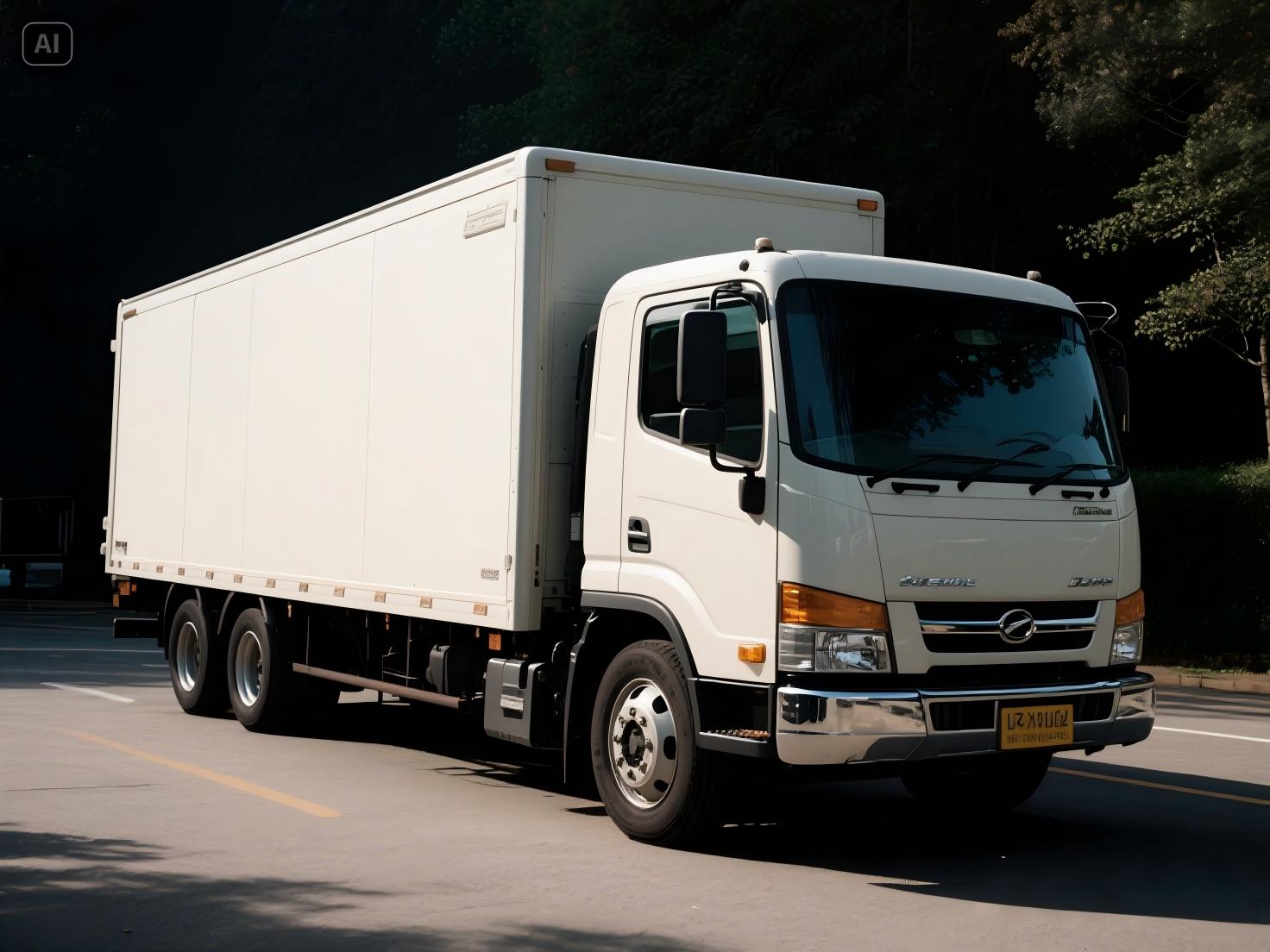
Figure 3. Fleet management deployments combine vehicle-mounted receivers, antennas, CORS/NTRIP correction data, and data logging for continuous tracking.
High-Precision GNSS Solutions for Surveying and Mapping
Surveying and mapping projects require survey-grade antennas with stable phase center, high multipath suppression, and receivers that can log raw observations for post-processing. The working condition is demanding: field environments with significant day–night temperature variation, long operating hours, and occasional RF interference. Receivers must support multiple protocols including NMEA 0183, SBF, RINEX, RTCM, and CMR, because the data may be used by GNSS processing software from different vendors.
The P-Box-X10 supports RTK horizontal accuracy of 0.6 cm + 0.5 ppm, 100 Hz position and observation output, and an Ethernet interface, making it appropriate for fixed or vehicle-mounted surveying systems. The JS-YAC130N is an integrated communication and navigation high-precision survey antenna covering GNSS, 4G, and Bluetooth bands, which can simplify installation on surveying vehicles and vessels. The JS-HAC100B is a three-system seven-frequency high-precision measurement antenna with a phase center error of ±2 mm, suitable for surveying, marine navigation, precision agriculture, and geological monitoring.
For surveying and mapping, a common error is to choose a receiver based on RTK accuracy only while ignoring antenna phase center stability and raw data formats. Project teams should verify that the receiver and antenna are designed for measurement tasks, not for consumer navigation.
High-Precision GNSS Solutions for Marine Navigation
Marine navigation and fleet management for vessels need GNSS receivers that tolerate humidity, temperature extremes, and long uninterrupted operation. A marine installation may also need heading output for navigation and channel surveying. The P-Box-AP55 and G27SH-AH are multi-constellation receivers that operate from –40°C to +85°C and support heading output when configured with dual antennas, including the G27SH-AH’s IP67 waterproof housing for exposed installation.
Survey antennas such as the JS-YAC130N list marine and channel surveying, dredging surveying, and port container operations among their target industries, with a 360° horizontal coverage pattern and GNSS band gain of ≥5.5 dB. For ship positioning and maritime dispatch, modules such as the JS-AD56UB8 and JS-TP26-U are listed for marine navigation and fleet management, providing a range of form factors for different degrees of integration.
Because marine environments cause corrosion and humidity stress, the project spec should verify the housing protection rating, the connector type, and the temperature range of the full assembly rather than only the receiver board.
Anti-Jamming High-Precision GNSS Solutions for High-Security Deployments
Projects in defense, critical infrastructure, or remote operation may face deliberate or accidental RF interference. Standard receivers can lose lock or output a degraded position. Anti-jamming GNSS solutions use antenna arrays and signal processing to suppress wideband, narrowband, and pulsed jamming while preserving the satellite signals that remain valid.
The JS-X168 is a five-array anti-jamming GNSS receiver with integrated anti-jamming antenna, designed for airborne equipment and high-security anti-jamming positioning. Its anti-jamming capability is 115 dB for a single interference source and 95 dB for three interference sources. It covers GPS L1/L2/L5, BDS B1/B2/B3, GLONASS G1/G2, and Galileo E1/E5/E6, and outputs NMEA on TX1 and SBF on TX2.
For projects that do not need a full array but still operate near jamming sources, receivers with built-in AIM+ anti-jamming, OSNMA anti-spoofing, and multipath suppression provide a practical first layer of defense. The P-Box-AP55 includes AIM+ anti-jamming, OSNMA anti-deception, TF card data logging, and interference monitoring; the P-Box-X10 adds IONO+ mitigation and APME+ multipath suppression.
How to Choose the Right GNSS Form Factor for Your Project
Once the application environment is defined, the next step is choosing a hardware form factor. The three main options are embedded modules, receivers, and smart antennas.
| Form Factor | Typical Integration | Best For | Considerations |
|---|---|---|---|
| RTK GNSS module / OEM board | Soldered or connectorized onto a customer PCB | UAV flight controllers, robotics, automotive ECUs, handheld terminals | Small size, low power, direct UART/CAN integration; requires external antenna and careful layout |
| GNSS RTK receiver / box | Standalone unit with housing and interfaces | Vehicle installation, surveying, base stations, fleet systems | Easier to mount and power; more interfaces; larger size and higher power than modules |
| Smart antenna / integrated antenna module | Antenna and receiver in one enclosure | UAVs, robotic platforms, portable systems, rapid prototypes | Simplifies RF design and antenna matching; size and weight may be higher than a bare module |
Embedded modules suit projects where the customer already controls the PCB and enclosure. A module such as the JS-CK39-A RTK board with built-in IMU reduces external sensor count and simplifies dead-reckoning design. Receivers suit projects where the system can include an external unit. Smart antennas suit projects where time-to-market matters more than board-level optimization.
For OEM and ODM projects, Jumpstar offers customization of modules, PCBA, antennas, functions, ports, interfaces, and logo. Monthly production capacity is 50,000 units, with a lead time of 30 days and a typical MOQ of 500 units. Every unit is 100% tested before shipment. Export markets include the EU, Middle East, and USA.
Step-by-Step Evaluation Process for a High-Precision GNSS Project
- Define the accuracy target. Write down the required horizontal and vertical accuracy at the point of use. For row-crop agriculture or survey data capture, RTK at 1–2 cm may be required. For general fleet tracking, a sub-meter or meter-level module may be sufficient.
- Map the environment to hardware requirements. Temperature range, vibration, humidity, sky visibility, and interference risk define the receiver grade. Industrial-grade receivers with –40°C to +85°C operation are necessary for outdoor vehicles and UAVs.
- Determine the correction source. RTK needs correction data from a base station, CORS network, or NTRIP service. Check whether the receiver supports RTCM 3.x, has a built-in 4G modem, or needs an external radio link.
- Choose heading and attitude method. If the platform needs heading without magnetic sensor errors, select a dual-antenna receiver or a smart antenna with dual RF input. Verify the heading accuracy at the achievable baseline length.
- Check interfaces and protocols. UART, CAN, Ethernet, USB, PPS, and event inputs must match the flight controller or vehicle computer. NMEA, SBF, RINEX, and RTCM support determine which post-processing software can be used.
- Verify anti-jamming and anti-spoofing needs. Projects near industrial RF sources, urban infrastructure, or high-security areas should include AIM+ anti-jamming or a dedicated array such as the JS-X168.
- Confirm mechanical constraints. Weight, dimensions, connector type, antenna mounting, and power budget must fit the platform. The evaluation should include the antenna, not only the receiver.
- Plan for testing and acceptance. Define a field trial that replicates the real environment: dynamic speed, vibration, tree cover, and rain. Use the same antenna and correction service intended for production.
Use Cases Across Industries
Long-Term UAV Manufacturer Deployment
A drone manufacturer has used the P-Box-X10 for five years and volume orders of 500 units. The receiver delivers centimeter-level RTK positioning and high-precision attitude output without relying on magnetic sensors, performing reliably under static and dynamic conditions. The customer’s stated results include: 544 hardware channels for simultaneous satellite tracking; triple-band multi-constellation support for GPS, BDS, GLONASS, Galileo, QZSS, NavIC, and SBAS; dual-antenna heading up to 0.03° at a 5 m baseline; 100 Hz position and observation output; and AIM+ multi-layer anti-jamming. The receiver integrates a TCXO, LNA, and 32 GB TF card slot, and supports base and rover modes.
This case illustrates two facts. First, a receiver with rich interfaces (3×UART, Ethernet, Type-C, TF card) is easier for a drone integrator to adopt because it removes the need for custom interface boards. Second, industrial-grade reliability in a 74 × 50 × 12.6 mm enclosure can be a differentiator in long product lifecycles.
Comparison of Representative High-Precision GNSS Solutions
For the evaluation stage, the table below compares several Jumpstar solutions as reference points. All values are from published product specifications.
| Model | Best-Fit Application | Key Positioning Accuracy | Hardware Channels | Special Functions |
|---|---|---|---|---|
| P-Box-X10 | UAVs, surveying, autonomous vehicles | RTK H: 0.6 cm + 0.5 ppm | 544 | Dual-antenna heading, AIM+, OSNMA, IONO+, APME+, 100 Hz output |
| P-Box-AP55 | Precision agriculture, vehicle, robots | RTK H: 0.6 cm + 0.5 ppm; RTK V: 1 cm + 1 ppm | 448 | AIM+, OSNMA, TF logging, interference monitoring; AP55H heading |
| P-Box-X6_Pro S | Vehicle-mounted, fleet, logistics | RTK H: 0.6 cm ± 0.5 ppm; RTK V: 1 cm + 1 ppm | 448 | 4G RTCM, heading output, OSNMA, TF logging |
| X43H-AH | UAV, UGV, autonomous driving | RTK H: 0.6 cm + 0.5 ppm; DGNSS: 0.4 m | 789 | Dual-antenna heading, AIM+, OSNMA, TF logging |
| G27SH-AH | UAV, marine, vehicle, monitoring | RTK H: 0.6 cm + 0.5 ppm; DGNSS: 0.4 m | 789 | IP67, CAN, optional radio, heading, TF logging |
| JS-CK39-A | Automotive, UAV, robotics, marine | RTK H: ±(8 + 1 ppm × D) mm | — | Built-in IMU, small 25.0 × 39.4 × 11.6 mm |
| JS-ARK37-3 | Robots, UAV, autonomous systems | RTK H: 1.0 cm + 1 ppm | 200 | All-system dual-band, magnetometer options |
| JS-RK26-U | Automotive, rail, robotics | RTK H: 1.0 cm + 1 ppm | 200 | GNSS+INS, dead reckoning, LGA package |
| JS-X168 | High-security anti-jamming | — | — | Five-array anti-jamming: 115 dB single / 95 dB three interferers |
The table is a starting point, not a complete selection. The decisive factors are the operating environment, the interface set, the correction workflow, and the installed antenna.
Equipment Set Typically Needed for a Project
A complete high-precision positioning system usually contains:
- A GNSS receiver or module (rover) installed on the moving platform.
- An antenna matched to the receiver bands, with the required phase center stability and gain.
- An RTK correction source: a base station receiver, a CORS/NTRIP service, or an internal 4G module.
- A data link to the flight controller or vehicle computer: UART, CAN, Ethernet, or USB.
- A logging method, such as a TF card, for raw observation data and post-processing (PPK).
- For heading-capable systems, a second antenna and a dual-antenna receiver.
- For GNSS-denied moments, an IMU- or INS-integrated module to bridge gaps.
For a UAV aerial surveying project, the matching equipment set is: the UAV flight control system, an airborne visible-light or multispectral survey camera, the battery, a single- or dual-array GNSS antenna, a 4G SIM card, a ground CORS reference station, a computer with RxTools debugging software, a TTL/USB cable, a TF card, and the RF feed cable.
What to Verify Before Finalizing the Supplier
- Manufacturing capacity and quality control. Confirm that the supplier can sustain project volume and performs 100% testing. Jumpstar reports a monthly production capacity of 50,000 units and a factory of 5,000 m², with 200 employees and 20 R&D engineers.
- OEM/ODM capability. If the product requires custom ports, interfaces, logo, or mechanical changes, verify that the supplier offers this service and the associated MOQ. Jumpstar’s OEM/ODM offering covers modules, PCBA, antennas, functions, ports, interfaces, and logo.
- Lead time and after-sales support. Jumpstar’s standard lead time is 30 days for OEM/ODM orders with an MOQ of 500 units, and remote support is provided after delivery.
- Long-term availability. Products used in industrial projects often remain in service for years, so component longevity and supplier continuity matter as much as unit price.
Frequently Asked Questions
Can a high-precision GNSS receiver operate in extreme temperatures?
Industrial-grade receivers such as the P-Box-X10, P-Box-AP55, and X43H-AH operate from –40°C to +85°C, with storage ranges down to –55°C. This covers outdoor vehicles, agricultural machinery, UAVs, and marine installations in both hot and cold climates. When selecting, verify both operating and storage temperatures, plus humidity limits such as 95% non-condensing.
What accuracy can I expect from an RTK GNSS solution?
With RTK corrections, horizontal accuracy is typically 0.6 cm + 0.5 ppm to 2 cm + 1 ppm depending on the receiver, baseline length, and antenna quality. For example, the P-Box-AP55 specifies RTK horizontal accuracy of 0.6 cm + 0.5 ppm and RTK vertical accuracy of 1 cm + 1 ppm. The JS-ARK37-3 specifies RTK horizontal accuracy of 1.0 cm + 1 ppm. Accuracy also depends on the correction service, sky visibility, and multipath environment.
Is dual-antenna heading necessary for all autonomous platforms?
Dual-antenna heading is necessary when the platform must know its orientation without relying on magnetic sensors, such as an autonomous vehicle changing lanes, a UAV keeping a straight flight line, or an agricultural machine steering accurately. A dual-antenna receiver outputs heading without magnetic sensor dependency, with accuracy of 0.15° at a 1 m baseline and 0.03° at a 5 m baseline. Platforms that do not need heading can use a single-antenna receiver.
Which RTK correction service should I plan to use?
The main options are a private base station, a CORS network, or NTRIP over the Internet. Receivers such as the P-Box-X6_Pro S include a global 4G module to receive RTCM correction data directly. The P-Box-X10 supports base and rover modes and can log raw observations for PPK post-processing. The choice depends on whether the project operates in an area with reliable cellular coverage or needs its own base station.
What is a realistic lead time for an OEM/ODM GNSS project?
For custom modules, PCBA, or antennas, plan for a lead time of 30 days after order confirmation, based on Jumpstar’s standard OEM/ODM setup. The typical MOQ is 500 units, with a monthly capacity of 50,000 units and 100% testing. If you are at the sampling stage, contact Jumpstar with your interface, accuracy, and environmental requirements for a project-specific evaluation. You can also download the Jumpstar company profile (PDF) for a full capability overview.
Conclusion
High-precision GNSS solutions are becoming a core subsystem in UAVs, precision agriculture, autonomous vehicles, robotics, fleet management, surveying, and marine navigation. The market data confirms the trend, but the internal logic is simple: as machines act on their position, they need positioning that does not contradict their movement. Choosing a solution requires matching the receiver, antenna, correction source, interface, and interference protection to the environment and workflow of the specific project.
For engineering teams evaluating a deployment, the first step is to write down the accuracy target, environment limits, correction source, and integration interface. The second step is to verify that the hardware supplier can support the project over its full lifecycle, including OEM/ODM customization, quality control, and after-sales support. Jumpstar is a source manufacturer in Shenzhen, founded in 2013, with a 5,000 m² facility, 200 employees, and 20 R&D engineers. Its annual output is 100,000 units, with 70% exported to the EU, USA, and Middle East. To move from the evaluation stage to a structured comparison, contact Jumpstar with the project’s technical requirements.
Need a high-precision GNSS solution matched to your project?
Contact Jumpstar for sample, quotation, or OEM/ODM inquiry.
Email: sales@jgnss.com
Tel / WhatsApp: +86 136-2236-7049
Address: Room 1305, Block A, Building 1, Lechuanghui Mansion, No. 1211 Guanguang Road, Longhua District, Shenzhen, China. 518110